The Ngaruroro is one of the great wild rivers in the north island, suitable for long, relatively easy packraft trips through fantastic scenery. There are countless options for making this trip long or short, with a helicopter or fixed wing flight to the start, a car shuttle and a through trip or even doing loop trips by walking into the start.
A straightforward overnight trip would be from Kuripapango to Kiwi Mouth Hut, then back to Kuripapango. For more than a night, just grab a map and the internet to scheme a trip anywhere from 1 to 10 (or more) days in length. The Kaweka and Kaimanawa ranges are crisscrossed with tracks, have many access points and lots of fantastic DOC huts, so you really can mix and match a perfect trip for yourself.
Private and public land
There is a lot of private land in the Kaweka/Kaimanawa Ranges, so whenever planning a trip in this area, make sure that you check on the Herena ā Nuku Outdoor Access Maps and the DOC Maps Website as well as the DOC website page about the Kaweka Forest Park
to ensure that you are on public land.
For example, most of the true right of the Ngaruroro River is private land, and parts of the true left too. Consider this when thinking about portaging, scouting and camping.
View Larger Topographic Map
Car Shuttle
The trip has a complicated car shuttle and having a shuttle driver is definitely a bonus. The road ends are; Poronui for the full trip, Makahu Saddle car park for the shorter trip and Kuripapango for a hard-core day trip. Whanawhana is a further option if you combine this with the lower Ngaruroro gorge (see seperate write-up) for 4 or 5 full days of paddling.
Arrange a pickup from Kuripapango on the Napier Taihape Road to take you back to the start to pick up your car. A long shuttle back to Poronui can be broken up by camping at DOC Glenfalls (although it is currently without toilets).
On Foot
Walk-in from Poronui station road-end off the Napier-Taupo Road or helicopter in with Helisika (Poronui) or East Kaweka Helicopters (Puketiritiri). After a long drive it’s a three to four hour walk to the Mohaka, initially through Poronui station along a poled route through private farmland then via sections of forested public land.
At the Mohaka River there is accommodation at Oamaru Hut but pushing on to fly-camp on the public land along the Oamaru-Boyd Track is not a bad option. This allows a more leisurely paddle if you can hit the river before lunch the next day. A further four or five hours walk gets you to the river near Boyds.
On the Water
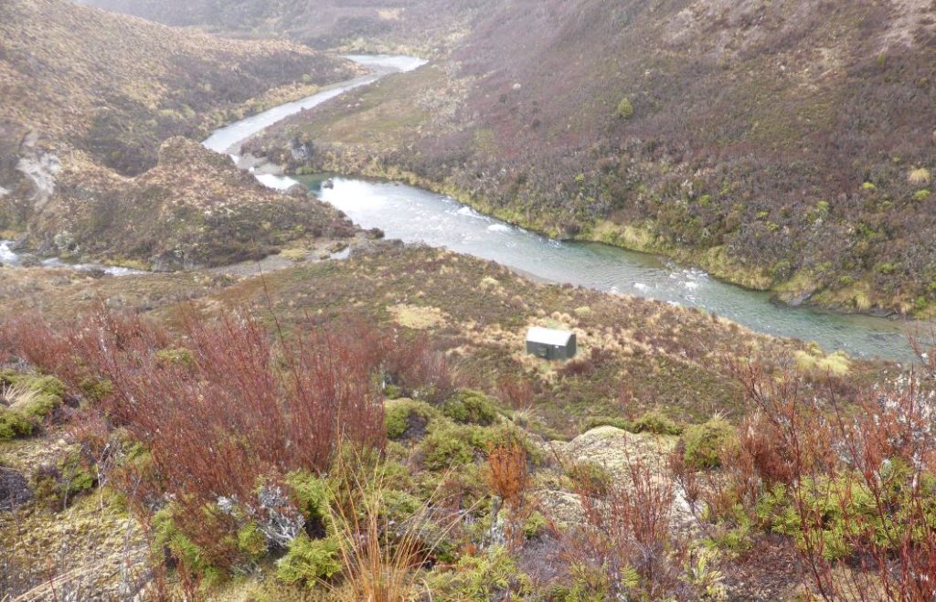
Inflating Packrafts at Boyd is an option if the river is high. “Walking the dog” by leading the packraft down the shallows on a leash is likely to be required to varying degrees in low flows. Remember: most of the true right is private land, so do your walking on the true left wherever it is safe to do so.
After a couple of hours in the tussock covered valley the Gold Creek confluence is reached. Here the river channel is relatively constricted and, with the tributaries extra flow, should be good for some paddling. Land on river right is private from this point but there is camping on river left above the top gorge.
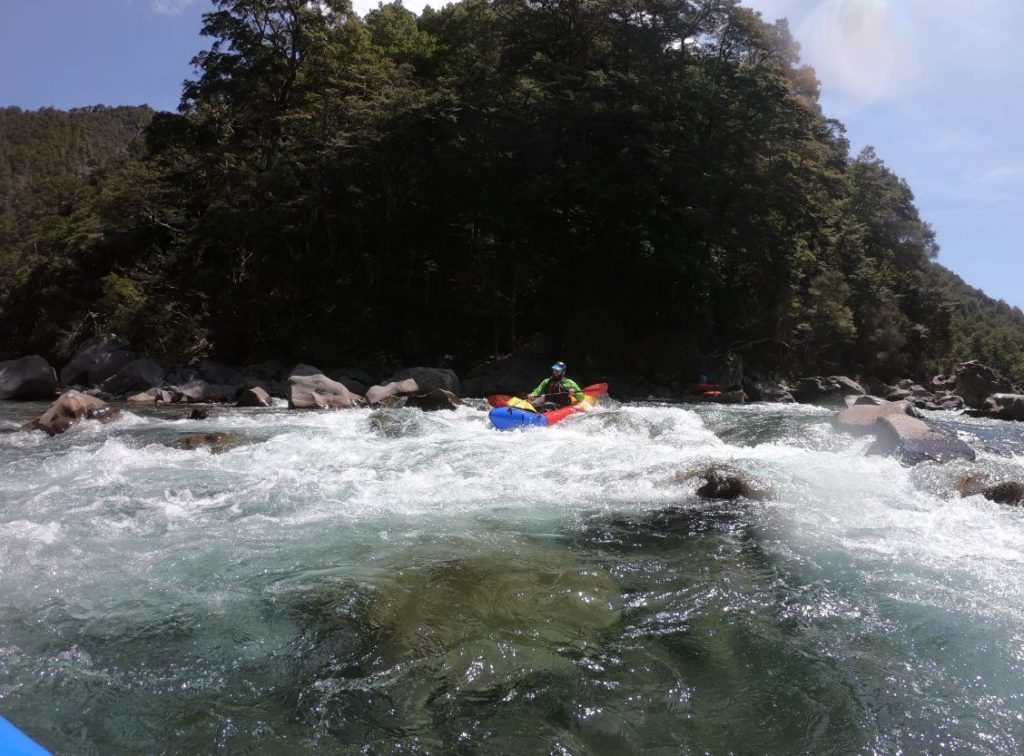
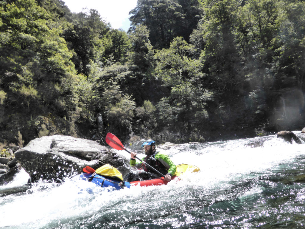
Half an hour on from Gold Creek and the pace picks up as the river enters the “Top Gorge”. This is the highlight of the paddling with lots of Grade II+ and Grade III rapids and fun drops. “Boofy” is a nice drop over some large boulders with a fun hole below. The section of the gorge around this rapid (middle third of gorge) is the hardest part of the trip – this can be avoided by starting at Ngawaparua. However most of the more challenging rapids are short with safe run-outs into pools. Inexperienced paddlers may choose to walk a number of these so don’t be put off by the GIII grading. In low flows some of these drops could get too bony to be safe.
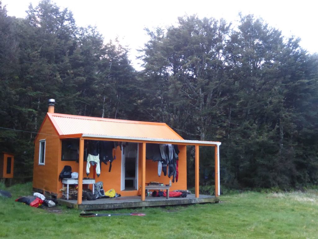
The upper river scrub gives way to lush beech forest by Te Rua flat (a DOC helipad and camping spot perched above the river). Logs are more common in the river from this point but experienced paddlers should be able to boat-scout most rapids. If you are ever unsure, then shore-scout any horizon lines and rapids with large boulders visible. Three to four hours on from Gold Creek the Ngawaparua (Harkness) stream joins from river left. The Ngawaparua hut makes a great overnight stop. We spent the night in the company of hunters and fisherman who had helicoptered in with East Kaweka Helicopters. As with all the huts down the river there is plenty of camping space available. Remember to leave room for helicopter comings and goings; tents, loose gear drying in the sun and helipads don’t mix well.
From Ngawaparua the river is mostly Grade II to II+ so this or Rocks Ahead can be a better starting point for less experienced paddlers. There is still no shortage of challenging and interesting paddling with lots of play holes and rock gardens to entertain more proficient paddlers. Rocks Ahead Hut is accessable via a track over Kaweka trig from Makahu Saddle Road end (a good days walk). This is the main variant for a shorter trip and car shuttle.
From halfway between Ngawaparua and Omarukokere Biv both sides of the river are public land until about a kilometre upstream of Kiwi Mouth Hut where the true right becomes private again.
Kiwi Mouth Hut has nice camping areas and there is a nice campsite 40 minutes on. It is opposite the Manson Creek Confluence but best accessed 200m downstream where there are some track markers on river left.
From Kiwi Mouth Hut it’s 4 hours to the road end with Cameron Hut about halfway. The days highlight is a “Fun!” Grade III- before the hut. There are a few takeout options with the Kuripapango Bridge being the last and the most obvious. If waiting for a scheduled shuttle chilling out or camping is best at the camp ground upstream of the bridge. A poorly marked access track up to the camping ground can be found as the river swings through a hard left corner.
You can carry on downriver 10km to camp and then knock off the lower gorge in one extra (very full day) if keen. Check out the separate Lower Gorge trip page.
Accomodation
Most parties allow three days of paddling for this section. Packrafters in summer low flows will need to allow more time. There are 6 huts along the way (Oamaru Hut, Boyd Lodge, Omarukokere Biv, Rocks Ahead Hut, Kiwi Mouth Hut and Cameron Hut), allowing you to take things at a very slow pace, and sleep in comfort if you wish. These huts are well spaced along the route so if fishing you could really stretch this trip out. Huts are busy in April and Spring with hunters and fisherman so always take a tent. There are plenty of camping opportunities.
Times
Tramp
- 8hrs from Poronui to Boyd Lodge
Paddle (times recorded at high flow)
Day 1 To Ngawaparua Hut 5hrs
- Boyd Hut to Gold Creek 2 hrs
- Gold Creek to Ngawaparua Hut 3 hours
Day 2 – To Manson Creek campsite 5 hrs
- Ngawaparua to Omar Biv 1.5 hrs
- Omar Biv to Rocks Ahead Hut 1hr
- Rocks Ahead Hut to Kiwi Mouth Hut 2hrs
- Kiwi Mouth to Manson Creek camp 40 mins
Day 3 – 3 hours to Kuripapango
- Manson Creek to Cameron Hut 1.5 hrs
- Cameron Hut to Kuripapango camp ground 1.5 hours
Allow longer for low summer flows!
Gauge
Ngaruroro River at Kuripapango.
Collectively our crew ran this at 11m3, 20m3 (Grade II+/III) and at flood stage 40m3 (gradeIII/IV-) Greg Duley reports running it in summer as low as 7.5m3 from Rocks Ahead (with a fair bit of rock scraping and portage).
Other Info
For more information on this river, including photos and videos, take a look at the Rocks ahead to Kuripapango: Packrafting Trip report by Chris Coutts
Updated Nov 2019 and 2024 Martin Robertson
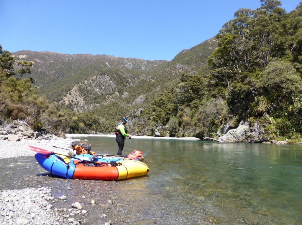
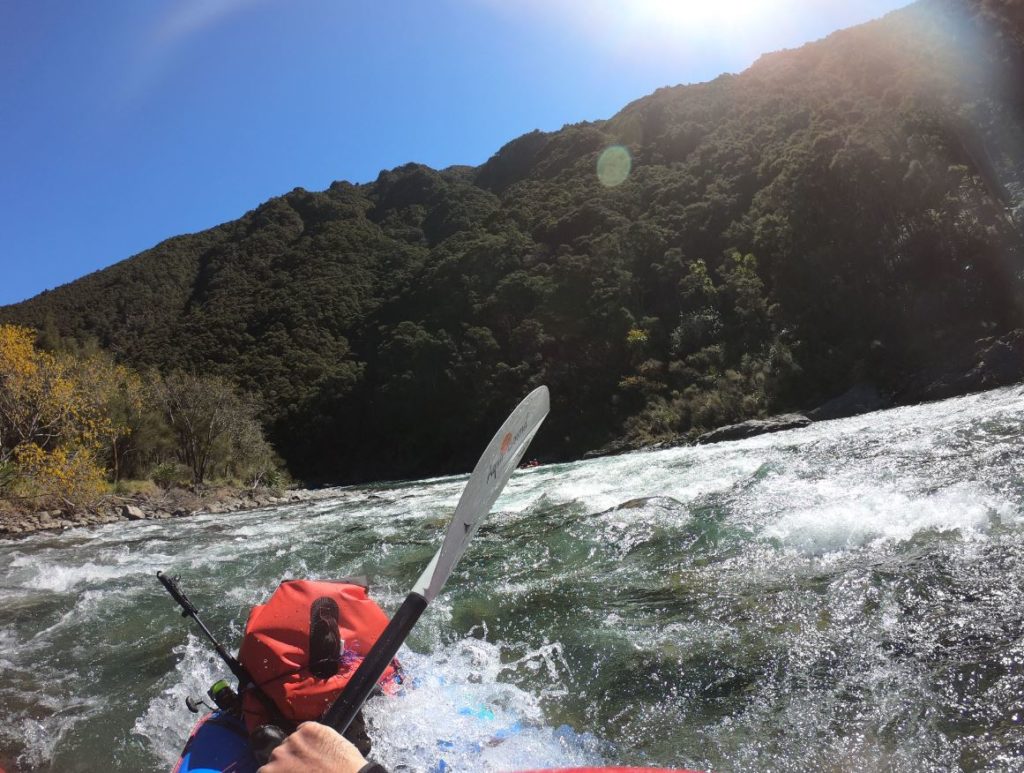


We did a 2 day trip from Ngaawapurua hut down staying at Kiwi. We choppered in with Helisika. Flow was 11 which was sufficient for all rapids. 1pr of blue duck about 4 km down from Ngaawapurua hut. Times were similar to those given and we got to Tapahiwhenua creek by 3pm which gave us time to explore up the creek by foot. Open beach forest and a lovely creek ending in a 40 m impressive waterfall. Worth the 1.5 hr round trip. We accidentally paddled past Kiwi hut as it’s not obvious from the river like the others. Take out at the confluence with kiwi creek. Below Kiwi hut the river is wider and dreamy with long easy rapids but took us 5 hrs to Kuripapango. We visited all huts on the way and no sign of anyone on a nice summer weekend. Huts were all well stocked with fire wood and some pots and pans but only 4 bunks.
I would do it again on a similar flow or higher up to 20 cumics.
Would starting at Ngaawapurua finishing up at Kuripapango be suitable for beginners?
What is the “grunty” rapid just before Cameron hut like?
Just did this river down from Kiwi Mouth Hut mid Jan 2018 – approx 10cumec. Spent most of the time trying to find water through the rocks, with a few bumps. Def portaged one of the bigger rapids just approaching Cameron Hut, otherwise all good.
Hi i did this trip with five family members and friends. We did this in just post flood levels. It is a trip that needs to be run in high water. We met later a couple of guys who attempted to raft it in normal flow, they ended up walking out.
Great trip. Good micro-climate – tends to be low rainfall. Lots of 90 degree bends as in a lava flow geology. Flying in is great, but a few days after we flew in , the plane crashed. Not sure if it’s still operating. nearby Mohaka is accessable tramping from Boyd hut also.