


This trip explores 36km of the seldom-paddled upper reaches of the mighty Whanganui River, which stretches from its beginnings on the flanks of Mt Tongariro, to the mouth near Whanganui, 290km away. Most people have floated down the spectacular sections below Taumarunui, but we were interested in exploring the upstream section where it flows through the Tongariro Forest. With only a small amount of information from the Graham Egarr book, this trip turned out to be an easy Class II+/III float at low flow with nice camping options, and simple walk-in access, through native established and regenerating bush. At higher flows it is bouncy and quite continuous Class II+ and III.
Vital Stats
- Gradient = 12m/km
- Length = 36km
- Grade = Mostly GrII+, one rapid GrIII (portagable)
- Type of river = Low volume, low energy, open, rock-dodger
Access to river
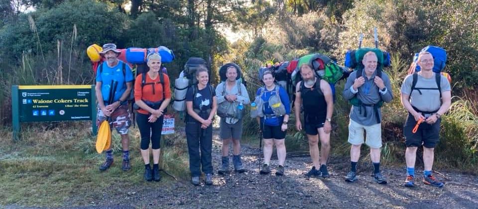
There are multiple options… We walked 2hr in through Tongariro Forest from Hillary Outdoors Centre (old OPC), to a point on the river which was once a ford (marked on the map where track crosses the river). Vehicles felt safe outside Hillary Outdoors. This was a super-easy walk in, along a quad-bike track, through some pretty sterile regenerating bush; this area was extensive milled for much of the 1900’s. But hey, you probably wouldn’t walk this track unless you had a great river at the end eh? The tracks around here are maze-like, so make sure you follow the mapped route above; some of it isn’t marked on the LINZ topomap.
A 2nd option, which we didn’t take due to low water levels, is a put-in at the Big Pipe upstream near Lake Te Whaiau. This is directly after the Whanganui Intake for the Tongariro Power Scheme; the river was very bony here and would have made for a very slow and frustrating first few hours.
A 3rd option, which a group used in April 2023, is to walk the section of Te Araroa from Hillary Outdoors to the Mangatepopo R, then paddle a hot distance down to the Whanganui. This would have the advantage of cutting out the slow section above the confluence, see below. It is about 2.5hours to the Mangatepopo which can be paddled/grovelled in high flows.
The Upper Whanganui River is controlled by the extensive Tongariro Power Scheme, resulting in a fairly reliable minimum flow of 0.3cumecs below the intake near Lake Te Whaiau to meet their compliance targets. There are no planned releases on this stretch, like there are on the Whakapapa River.
The first 5km (above the Mangatepopo confluence) were fairly slow going, with no sizeable rapids and a lot of “walking the dog” and dodging rocks. You could tell the river level didn’t vary much by an obvious moss-line on the rocks, and when we paddled in Sept the level was about 100mm below the moss line. But once the Mangatepopo feeds in (another 0.5cumecs), things pick up a bit, and the regular rapids reach a healthy Class II.
The River
And so things continue for the next 17 km, through more established bush on both sides of the river, until the river emerges into farmland. Generally the river keeps you busy with negotiating rocks, while nothing felt “pushy”, and the river can be regarded as low-energy. The crux comes about 1/2way through the trip (see point on map), with a Class III rapid and followed shortly after with a narrow gap which our rafts couldn’t fit through. Both can be portaged on river-left.
There are no gorge sections, so in event of emergency, escape can be made through the bush on either side
Also of note is the Limestone Cave marked on the topomap… It ain’t bloody there! 6 of us traipsed around in the bush for an hour, then paddled on with tails between our legs. If anyone knows any more info here, please get in touch.
Once emerging from bush after the Hohotaka Rd bridge, the river widens, flattens out, and slows down, with the odd Class II rapid. There are some nice play spots a few km above the takeout. These are formed by ledges in the sedimentary rocks at the end of the last mini-gorge.
When we paddled in Sept 2018, there were impressive numbers of Whio hanging out on rocks. We floated past a group of 20+, which felt pretty special. We didn’t realise at the time, but Oct-Dec is hatching and fledgling season, so don’t get too close, or even better plan your trip outside this time. See Whio year calendar.
Water was clean, as you’d expect, and we had no problems drinking it. A little surprising was that it was not crystal clear though, perhaps as a result of Lake Otamangakau feeding into it further upstream.
Land use and camping
At various places on the river, there are good campsites, some marked on the map above. The whole way down on river-left, camping is permitted in Tongariro Conservation Area. Pukepoto Ecological Area spans the middle section on river-right, so camping is good there too. Check WAMS if in any doubt. For larger groups camping can be tricky – find a stout manuka staff to smash some blackberry.
Go Bush Adventures also have a lodge called “Te Whare O Nga Whio” marked on the map about 1/2 way down, if you’re after a more civilised nights sleep.
Getting back
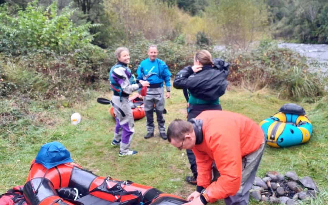
The beauty of this trip, is that the river flows beside SH4 once it emerges from the bush. This gives good hitching options back to the start off SH47. Instead of hitching though, we got in prior contact with Blazing Paddles, who run their service from a base at Piriaka beside the power station. Glenn was super friendly, and let us leave a shuttle car in his locked yard for a box of beer. We also ended up dossing in his cosy cottage accommodation at the takeout, for a small sum.
Another option is to take-out at Kakahi, a few km upstream of Piriaka; This would skip the flat wide farmland section, but I’m not sure how secure a car would be there. An alternative take-out is to walk across Whakapapa island to a picnic area at teh end of Te Rena Road Kakahi.
Flow
As mentioned above, the upper part is mostly controlled by the Tongariro Power Scheme, and runs at 0.3cumecs. There is a gauge near the takeout at Piriaka on the Genesis Energy page: Whanganui at Below Piriaka – river-flow
Flows above 20m3 are desirable the April 2023 group had a falling flow form 30m3 down to about 20m3. This higher flow took the 42 traverse section of the river up at least half a grade (cf Chris’s 13m3 grovel).
References
North Island Rivers – Graham Egarr – p78
Video credit goes to Martin Robertson
Updated M Robertson May 2023