


A challenging alpine route to a long braided valley float, through some really big mountains.
Thanks to Nick Neynens who gave permission to use the trip report on his blog as source of info to make up the original page here. Nick is a very fit, bold and fast adventure racer, so his times were extremely quick to say the least. Thanks to Mary Williams and James Hobson for more information and photos which give times that are more reasonable for the majority of ‘mere mortal‘ fit packrafters.
Planning
This trip requires a wee bit of prior planning to pick the right time and get the required permissions for the trip.
Water levels and avalanche hazard
River levels are the main factor in determining how many days this trip takes:
Like most braided rivers, they get very low in late summer. For best flows, you’d do this trip through spring during the snow melt. However, early spring the pass is subject to snow and avalanche hazard, so the ideal timing is when most (but not all) of the seasonal snow pack has melted. Check out the Aoraki/Mt Cook Avalanche Advisory before you go, and ensure you have the knowledge and skills to assess snow stability and alpine hazards if attempting Jamieson pass when snow is present.
A bit of rain before your trip will also help!
There’s no easy way to check levels in the Dobson before committing to the trip, but the nearest gauges give some indication of flows in the region:
Glen Lyon Station might be able to let you know about river levels if you ask nicely.
Time required
Approach on foot: 2 days
- Day 1: Car shuttle then Birch Hill to Campsite around 1050m contour (2hrs hiking)
- Day 2 Campsite to Reardons hut (DOC) 6-10hrs (depending on fitness and snow conditions)
On the river 1 to 3 days
With low water, the paddling is pretty slow, with bum scraping and walking between braids. Anticipate the need to camp or stay at huts along the way (Check the land status, and get permission in advance!)
With a bit more water, pace increases and you can stay in your boat more and paddle the river in a long day.
Example flows and times:
- Late January 2017. Nik Neynens took 10hrs to reach to Reach Le Crens Hut, and approximately 5hrs fo Lake Ohau.
- 28 Dec 2024: Mary Williams and James Hobson completed the paddle in a double packraft on 28 December 2024. They did the paddle in a 10hr day when the Twizel River gauge was 4.3 cumecs and Mary Burn 0.1 cumecs. They reported bum-scraping and a moderate amount of walking/hauling across braids for the first 20km, but good pace after that.
Land status and access
The route weaves its way through various types of land: Aoraki/Mt Cook National Park, Ruatanwha Conservation Park and the private farm land of Glen Lyon Station. You must study the Walking Access Mapping System website so you know the location of public and private land when planning this trip.
Although the river itself is always publicly accessible, there is a small section of the trip where you have to cross Glen Lyon Station around Reardon’s hut (upper Dobson). It’s important to call Glen Lyon station (03 438 9644 or 03 438 9642) to ask for permission to cross their land. They also own a few of the non-DOC huts in the valley ( Station and Le Crens) which they are often willing to let you use if you ask permission. And if you ask nicely, they will probably be able to tell you about the flows in the rivers at present.
In the Dobson Valley, there are several DOC huts (Reardon, Waterfall-[derelict], Kennedy Memorial and Crough) which are in the Ruataniwha Conservation Park . There are also parcels of public land where you can camp if you wish.. Just do your homework beforehand to check where these are!
The trip
Approach on foot
Thanks to Mary and James for this trip report:
Day one: Birch Hill to campsite at 1050m in Birch Hill Stream (2hrs)
Mary and James hiked up for 2 hours in the afternoon, having shuttled a car in the morning, and made camp on a flat area about 2km as the crow flies from Jamieson Saddle, just as some rain set in for the night.
Day one: Campsite to Readors Hut (8-10hrs)
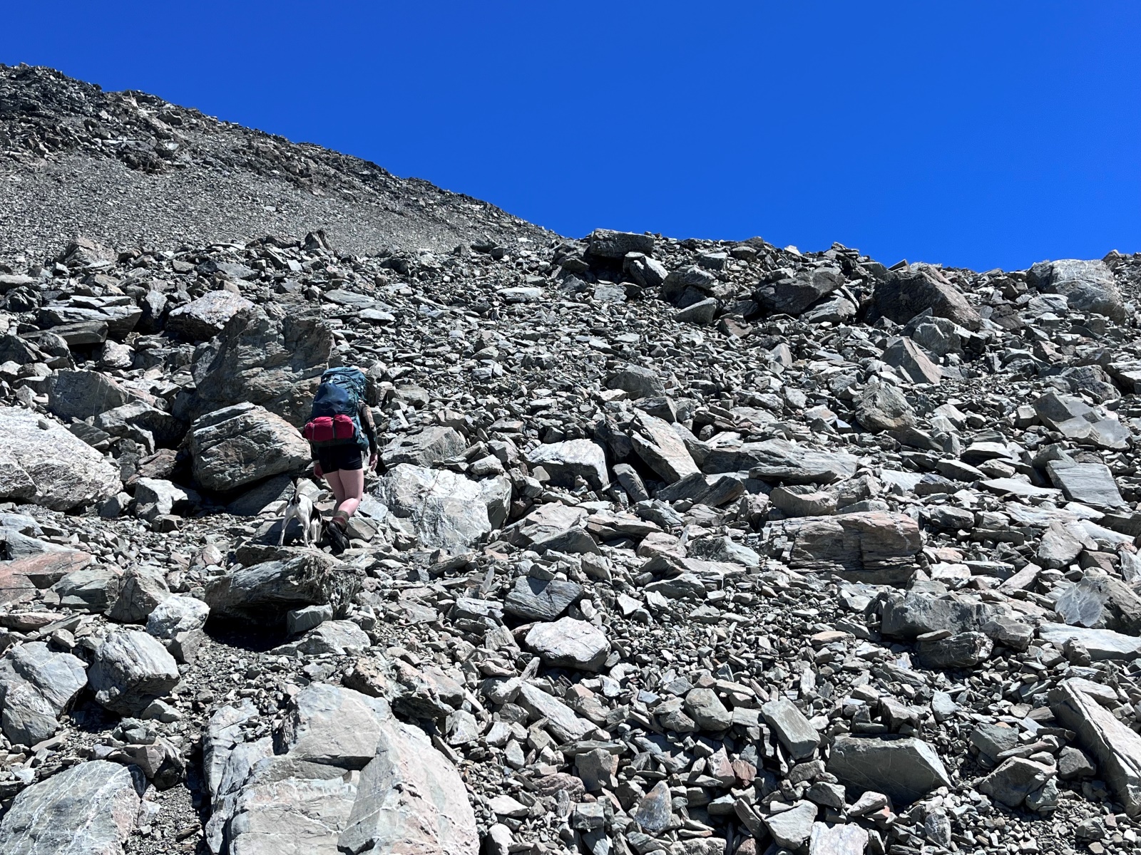
The weather cleared in the early morning and day two was an absolute summer scorcher. It took us four very steep, hot hours to reach the saddle. In late December 2024, there were some patches of snow to cross but nothing technical.

The biggest challenge was the heat, scree, and the boulders. There was quite a bit of ungainly clambering with bulky packs.
The saddle is at high elevation (2138m) and often holds snow in spring and early summer. Crossing this pass requires alpine experience, judgement and good weather/snow conditions. Crampons and Ice axe may be required and avalanche danger may be present, especially in spring/early summer. See the Aoraki / Mt Cook Avalanche Advisory before you go.
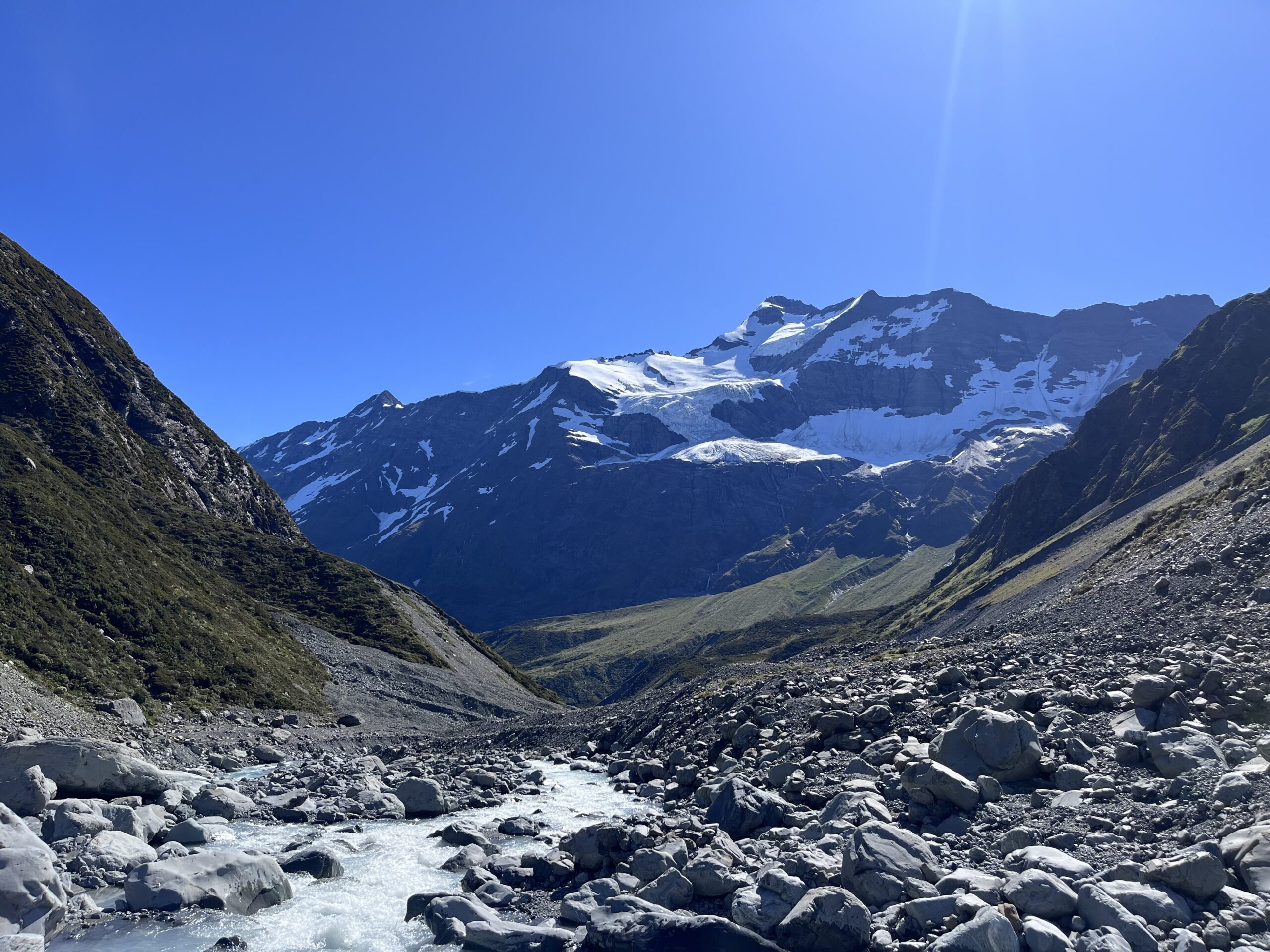
Down the other side it was a fairly straightforward and quick descent to the upper reaches of the Dobson.
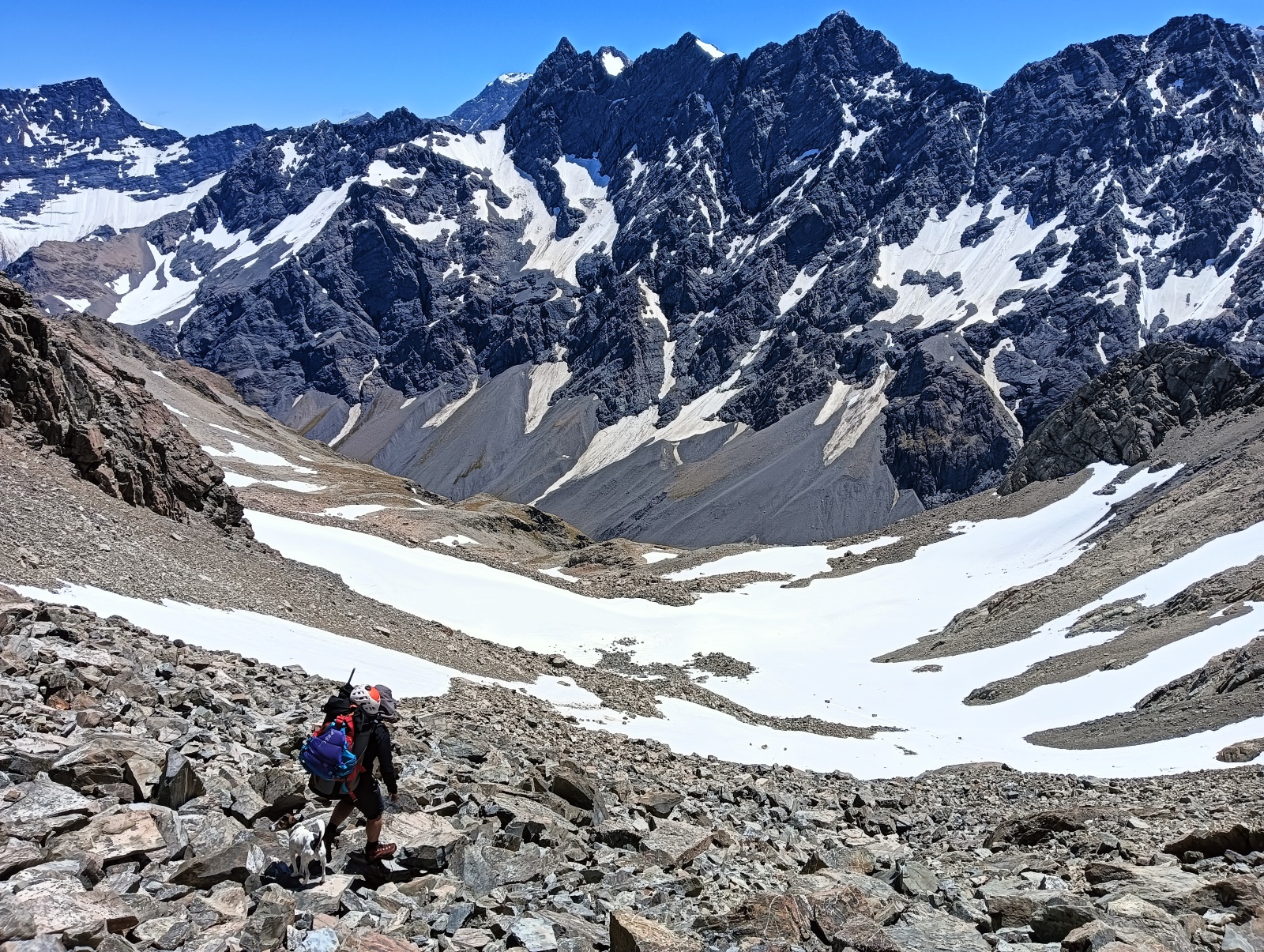
Once in the waterway it was much slower travel again as there was a lot of scrambling around moraine and large sharp boulders. About 6 hours from the saddle to the hut.

With lighter packs, (no tent, no rifle etc) you could probably shave an hour or two off the crossing. But be prepared for a long day, and start early!
On the river (I/II)
Reardon’s Hut to Lake Ohau via Dobson and Hopkins rivers – 50km / 10-15hrs
Thanks to the rain we’d had in the days prior, the river must have been running a bit higher than when Nick did it. The top 20-ish kms was still quite bum-scrapey and required a bit of getting out and hauling, but after that it became a pretty good flow – just your typical braided river, really.
Thanks to the increased flow we were chugging along quite quickly.
Ōhau means ‘place of wind’ and its no joke. Wind crashes over the main divide if any is forecast from the NW through SW, and its exposed to a southerly. On days with light winds forecast, the valley breezes blow strongly from the south by the afternoon, sometimes creating huge dust storms from the flats.
The wind definitely picked up after the confluence with the Hopkins – a southerly was on its way in – and it’s easy to imagine getting blown away in stronger winds. We were grateful to be in a double packraft here, and decided to just keep paddling instead of setting up camp as we were making good time.
The Hopkins is a significantly bigger river than the Dobson, so expect more powerful eddies and wave trains. It still a gravelly braided river, so it is mostly grade I with occasional grade II wave trains.
We ended up back at the car at 7pm. It was a 10-hour day on the river from Reardon Hut and 50kms of paddling. Our car was parked right at the end of the Hopkins where it flows into Lake Ohau.
Nick’s experience in lower flows, late January 2017
Nick reports that the upper Dobson was often pretty shallow and bony, requiring some pushing or portaging, especially where it braids out below Waterfall Hut.
He took about 10hrs from Reardons to Le Crens Hut. Below Le Crens Hut, there was enough water to paddle without any scraping or portaging all the way to the Hopkins confluence.
The takeout
Take out by the Hopkins river mouth, where the road is close by.
There is public accessed via the Glen Lyon Road as far as Glen Lyon Homestead. Permission is required from Glen Lyon Station if you want to drive further (4WD required).