


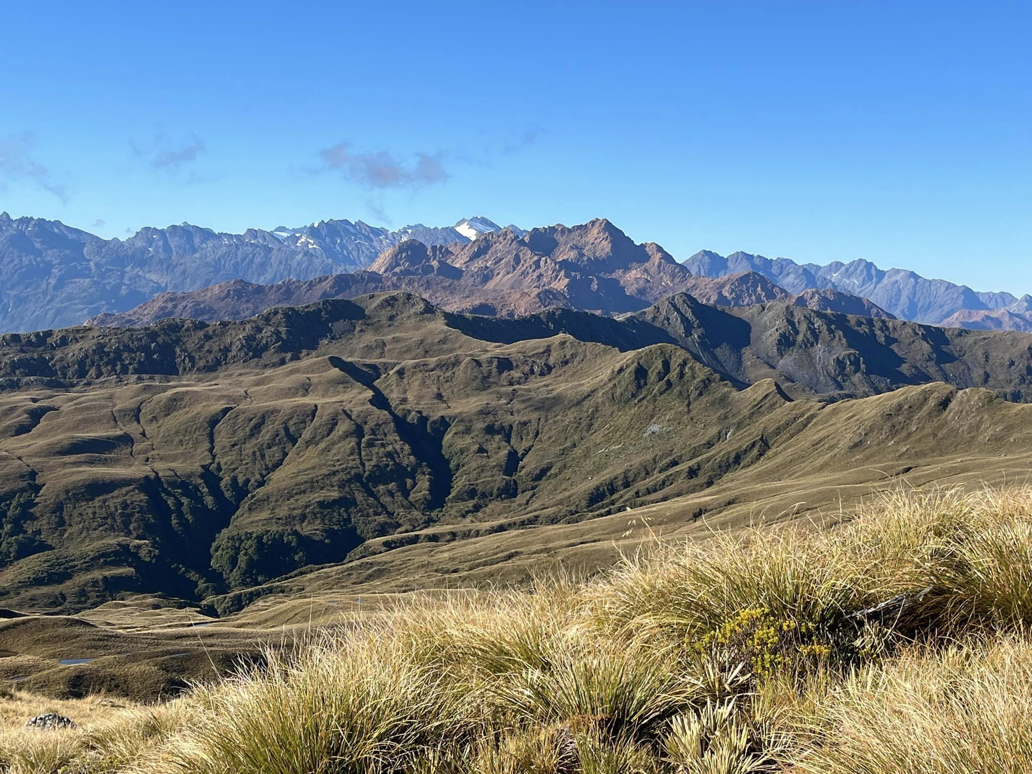
The Cascade is very scenic and remote river, draining from headwaters right in the heart of the Olivine Wilderness Area. Approaches are challenging: you’ll need to sign up for a bit of bush bashing and effort. However, the delightful middle reaches of the river (II/III) are an enjoyable objective for packrafting groups.
We will first describe the paddling, from top to bottom, then include a few trip reports from people who have walked various routes into the catchment.
Thanks to Jeremy Platt, David Stephenson, Pete Robinson, Bryan Moore and Kat West for the information to compile this trip page. All photos courtesy Jeremy Platt and Aaron Reimer.
View Larger Topographic Map
On the river
The sections are described from the headwaters, through to the road end.
Within the Wilderness Area
Upper Cascade (?)
Durwood falls (50m according to the map) guards the upper reaches of the Cascade, which appear steep and technical. Apparently this has been paddled by Gareth Fryer, but there’s no details available as yet.
Cascade Gorge (IV+)
Below Durwood Falls, the map labels the Cascade Gorge. This has been paddled by hardshell kayakers: who flew to the edge of the Wilderness Area at Falls Creek, then carried their boats in to the base of Durwood.
“A few hours of excellent grade IV/IV+ in a gorge, all paddleable or portageable at medium flow” according to Graham Charle’s whitewater guidebook.
Below the Wilderness Area boundary
Paddling this section to the road takes about one long day. Aaron Riemer posted a video of paddling this section on Facebook.
Middle reaches to Kappa Gorge (I/II)
The paddling involves beautiful grade I and II rapids in a very scenic spot. As in all west coast rivers, there are often trees and wood in the river, so keep an eye out for these. This section can get a bit bony in drier conditions.
The valley walls start to close in, and at a tight left hand corner, the straightforward section ends. If the flows are up, it would be technically possible to bypassing the Kappa gorge; if you can find a safe take-out. The bypass would be via the .316 feature but involves lengthy and difficult bush bashing.
Kappa Gorge (II/III+)
This is named after Kappa Creek which enters the gorge near its end.
In low flows there are options for portaging and paddling at grade II/III. In medium flows, the gorge is solid and technical paddling at grade III+ with fewer portaging options.
The gorge is incredibly beautiful with a bunch of amazing living walls of moss.
Below Kappa Gorge to the takeout (I/II)
From the gorge the river goes back to grade I and II. This section is relatively quick (roughly 3hrs in medium flows) , with one or two drops needing a shore scout for hazards.
If you scouted the takeout before your trip, things should be easy when you reach ‘The Bend’. You’ll know the spot where the tricky-to-see-from-the-river quad bike track leaves the river.
If you haven’t scouted ahead of time, as you approach ‘The Bend’ begin looking early for eddy options on the true right, because there aren’t many. You might be able to scramble into the bush and find the flagging tape of the up-valley foot track, which you can follow downstream to the ATV track. If you miss the track, remember that the farmland downstream is private property, and permission is required to cross it to reach the road..
Approach on foot
We’ve recorded a series of options and reports for getting to the Cascade. These are all shown on the map, but the lines are indicative only: they may not be the best route or the most efficient travel.
Scout the takeout first.
On the Jackson River Road, there is a DOC information panel about 400m north of the .172 feature. Roughly 30m beyond the info panel a very clear quad-bike track begins. This track is easily followed through public land for about 15 minutes to the Bend. The line on the map is from a GPS track provided by a group that walked this route in late 2023.
Spending the time to be sure of the takeout can save time at the other end: The land below the bend is private farmland, and permission is needed to walk between Charlie’s Bump and the Jackson River Road..
Bush bashing up the Cascade Valley. 3-4 days
- 2-3 reasonably long days up the true right.
- 1 long day paddling to the Cascade Road end.
Moir’s Guide North has detailed track notes for walking up the Cascade Valley: get yourself a copy before you go.
Via Matry Spur and Woodhen Creek. 2 days
- 1 day Road end via Martyr Spur to camp by tarns southwest of Matyr Hill.
- 1 day down to Woodhen Creek. Float Woodhen if water allows then paddle the lower Cascade (II).
From the Hollyford. 7-8 days
A difficult thorough trip from the Hollyford Road end, via the Red Hills Range.
- 1 day running the shuttle: 7hrs driving between the road ends!
- 3 days from Hollyford Road end to Big Bay
- 3 long days from Big Bay via Red Hills Range to the Cascade River
- 1 long day paddling to the Cascade Road end.
Below, Jeremy Platt recounts his journey in February 2024.
Hollyford road end to the Pyke
The first part of the trip to the Pyke River is part of the famous Hollyford-Pyke route.
Pyke to the Ridge
Once at the Pyke we walked upstream to Durwards Ck which was pretty easy going with nice grassy sections a little ways from the river and then pretty clear forest sections. At the confluence, we made good progress walking along the river bed (river was low) before then turning to the East and starting the descent up the ridge to point 1166. This is where things started going to s#$t.
We read in an earlier trip report that the range from the Pyke River to the Cascade River could be covered in a day – I thought it would probably take us 2.
Day 1 on the ridge:
Moving up this ridge through variable but often thick scrub and with heavy packrafting packs, we only made it up to a tarn shortly past point 1166. Here we camped for the night after a 14 hr day.
Day 2 on the ridge:
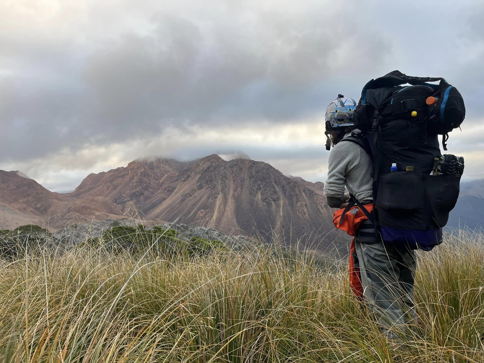
With an alpine start, we hoped to fly along the tops and then down to the river before some bad weather due the following day. The walk along anticipated open tops was slow going. We waded through slippery highish alpine vegetation and it took us 3 hours to make it to point 1208, just as some low clouds came in.
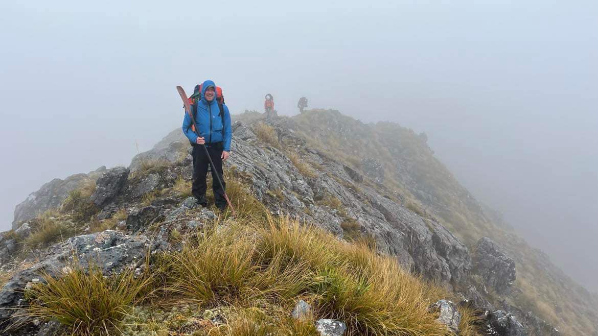
A navigational error in cold rain and low visibility at point 1306 cost us another 90 mins. The ridge from point 1306 to point 1259 looked fine on the map, but had plenty of unpleasant suprises in store. We endured of tons of PUDs (Pointless Up and Downs), slippery high alpine vegetation and steep drop offs.
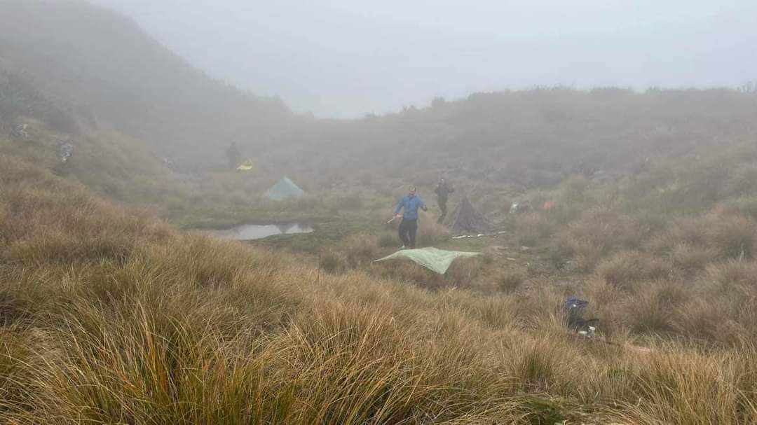
Near point 1259 at around 4pm, one of the team sustained a knee injury, so we headed down to the tarn to the east hoping for some protection from the incoming storm.
Day 3 on the ridge:
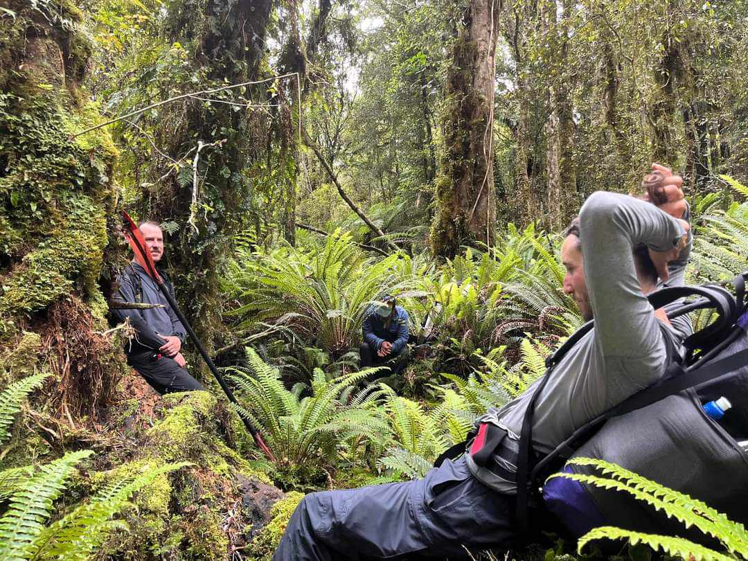
The storm reeeealy came in dropping 150mm of rain throughout the day. With no visibility and to let injuries and fatigue subside we spent the day in tents.
Day 4 on the ridge:
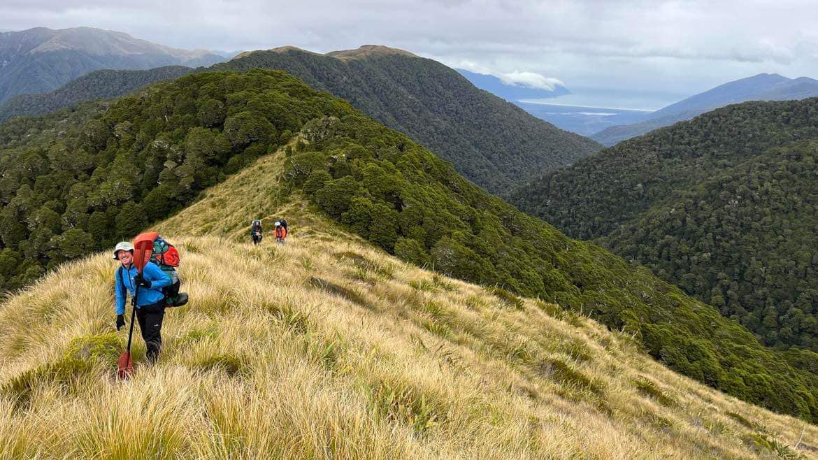
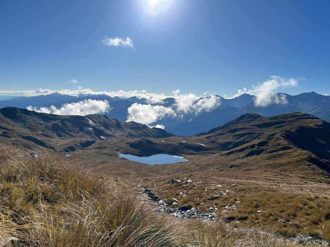
Greeted by glorious sunshine we were stoked to head back up the ridge to point 1259, where we were greeted with epic views of the Olivine Range to the East and the Ocean to the West.
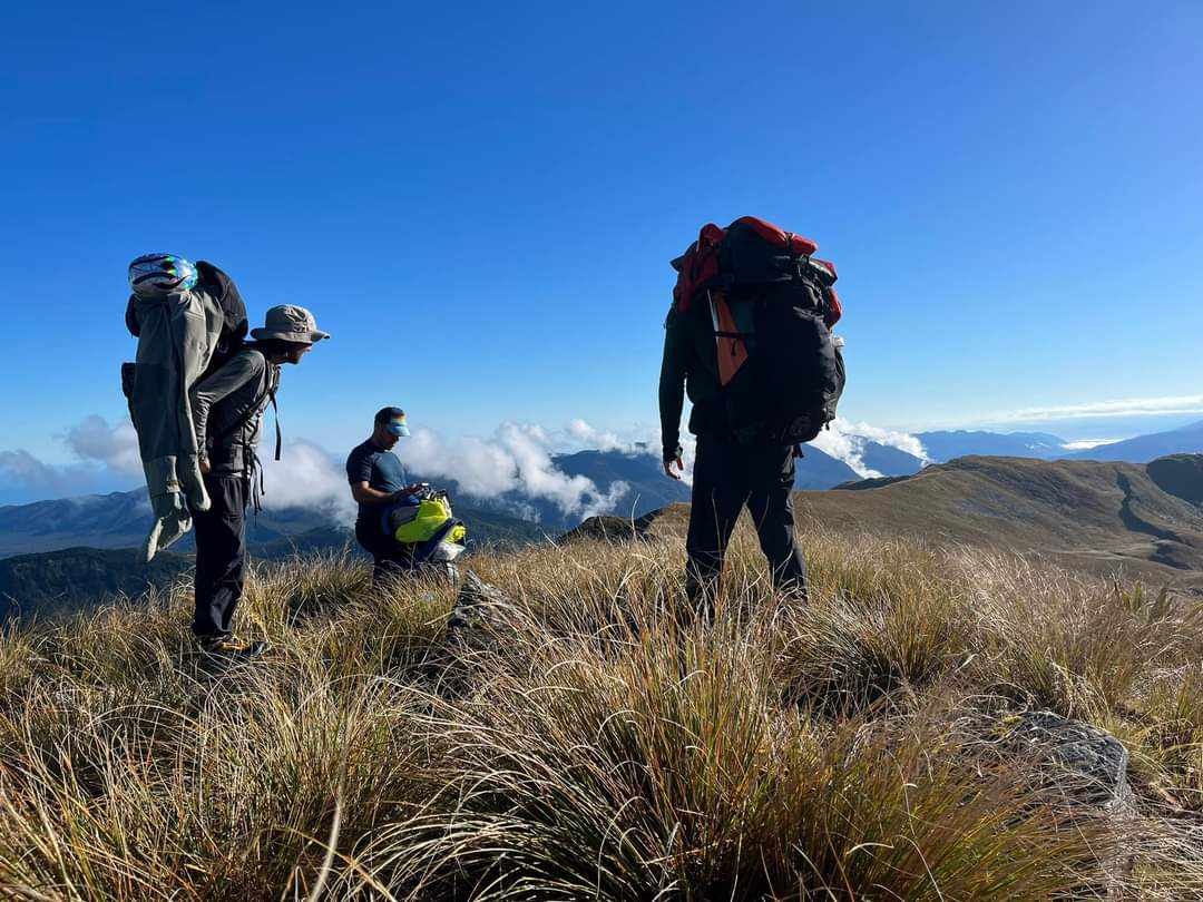
We also had amazing walking conditions along the ridge until we got to somewhere between point 1220 and 1090. At this point we thought we may get onto and complete the river that day after another early start, but alas the progress slowed significantly after this point.
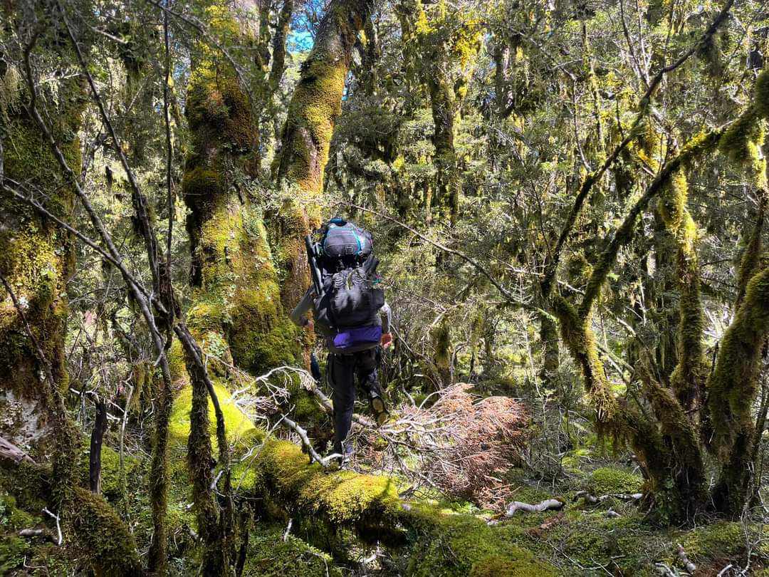
Moving into the treeline, we came across some of the most beautiful and slow terrain I have experienced. Incredibly thick moss grew on a layer of downed tree branches, which was incredibly beautiful, however treacherous to move through as it was easy to slip between fallen logs and boulders beneath. After many hours of moving through this forest towards point 906 we were looking for a ‘remarkably clear ridge’ described in an earlier trip report, but unfortunately only found thick, treacherous and steep, but we managed to get down and onto the riverbed at last light for another 15 hour day.
Update: Pete Robinson gave us the location of the ‘remarkably clear ridge’. The trip map has been updated to show this descent line. The line is roughly from the .890 feature, almost due east down a well-defined but narrow spur. Jeremy’s group took a line nearly a kilometre further north.
Glenn Murdoch of Blue Duck Packrafting has run the Cascade from Durward Falls. It’s supposed to be 76m.
The river above the falls is Grade 3.
Next generation – your turn.
We also attempted the Monkey Puzzle Gorge on the Martyr, tributary of the Cascade. It was very hard work in hard shell kayaks. Mentioning this because it would be a better trip in packrafts. Unladen packrafts are best. The trip time and info on this comment is for the Matyr attempt