Overview
The Toaroaha River is one of the go-to destinations for spectacular walk-in whitewater kayaking on the South Island’s West Coast. Hard-shell kayakers have paddled it from the Top Toaroha Hut! (See the Whitewater NZ RiverGuide entry for the Toaroha)
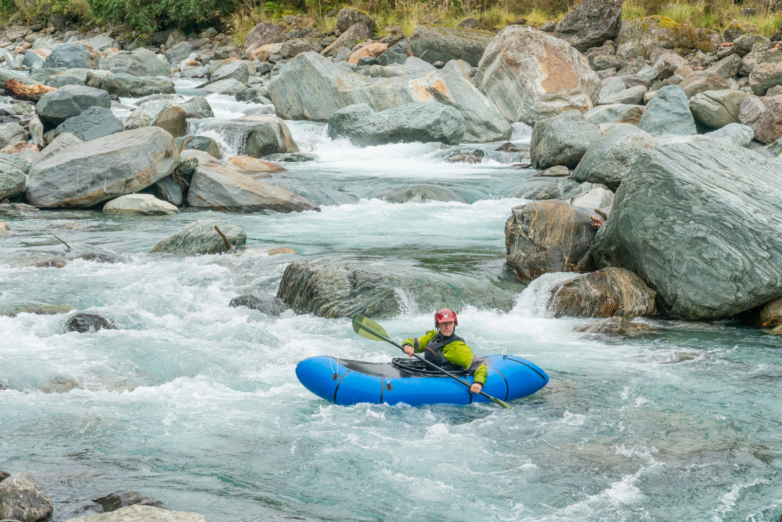
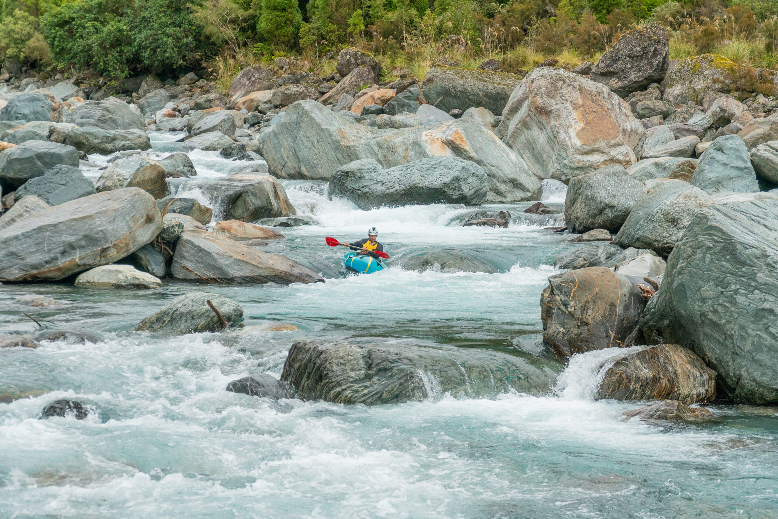
Below the Toaroha Canyon, the lower Toaroha is a grade IV section that makes an excellent trip for advanced packrafting groups with suitable paddling, scouting and rescue skills. The lower Toaroha offers a variety of boulder and bedrock-style rapids that are accessed via a well-maintained access track. Most of these rapids are in the grade III to IV range and several have objective dangers presented by siphons and sieves.
Teams need to prevent or manage the potential for a capsize at several critical points on the journey. The bedrock sections are also characterised by sharp fractured greywacke that awaits its chance to slice through a flimsy packraft. As well as keeping this in mind when scouting rapids, carrying a solid repair kit (or two) for this adventure is essential!
Rivers change!
Like most rivers, things change dramatically with each flood. The west coast floods regularly: this description was correct at the end of the 2023 summer, but treat each trip as though it has changed completely (because it probably has..)
Flows
Visual: there’s no gauge for this run, but packrafters will prefer relatively low water levels. If it looks manageable but neither scrapy nor too pushy when you reach the river, that’s a good sign…
Thanks to Shane Orchard for the text and images on this trip page.
View Larger Topographic Map
Getting to the carpark
Middlebranch Rd is essentially a gravelled farm track. Although it is in fairly good condition, a half-decent car is a good idea. There have been issues with people not being respectful of this access point. You’re driving through Sheridan Farms, so show courtesy and follow the basic country code. Drive slowly past the farmhouse, if you see the farmer, stop and say hello, give farm animals a wide berth, and pay particular attention to the possibility of an electric fence wire strung across the road! Leave any gates as you found them, leave the dogs at home, and park by the DOC signposted car park.
Approach on foot
DOC orange triangles lead off down the farm track, which switches back down a terrace then sharply up-valley again. You’ll note a sign that asks you to follow orange triangles through adjacent paddocks when stock are present on the farm track.
Take note of Papauma Stream: access from the river up the stream bed to the track is legal walking access. Other exits from river to track cross Sheridan Farms.
Keep a good eye out for DOC triangles until you reach the native forest, where the track becomes very easy to follow. This benched track provides straightforward access to an open section of the river valley, which is the put in for the lower Gorge.
To reach the T-Canyon exit waterfall
The track continues along the true right bank, but at some point you’ll need to start using a little creativity to continue up valley to reach the infamous T Canyon exit waterfall (located approximately 3 km upstream near Ellis Creek).
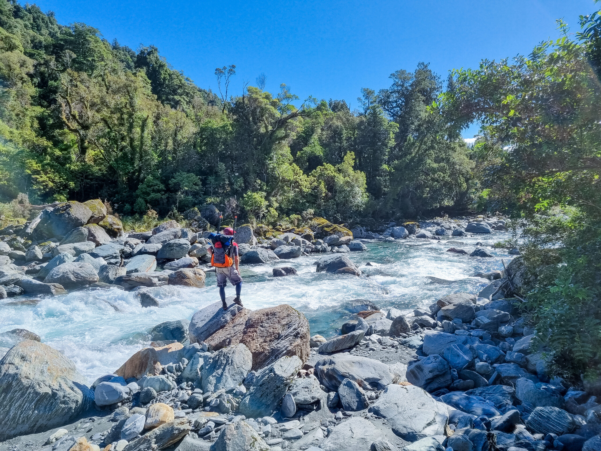
Boulder-hop upstream scoping the rapids as you go. Soon you’ll see the first of several longer boulder garden-style rapids with multiple features and moves to memorize. Most of these will require bank scouting on your descent to confirm the memories you may have tucked away from the walk-in. The steepest of these rapids features a relatively long entry sequence that leads to a narrow chute of steeper whitewater. At lower flows such as those likely to be run by packrafters, there is a shallow hole located midway through this steep section, along with the potential for several other shallow rocks and other obstacles hiding in the aerated water. Scope this section carefully as there are also multiple siphons under large boulders nearby.
The valley walls start to close in, with steeper sides. As you approach the last beach on the true right, bedrock walls begin on both sides. The T Canyon exit waterfall lies only a few hundred metres further upstream, and getting there is a highly recommended detour! Gear up for some upstream eddy hopping and out of boat scrambling around the next few corners.
Around the first bend you’ll spot a 3m drop and above that is the T canyon waterfall which drops into a large pool.
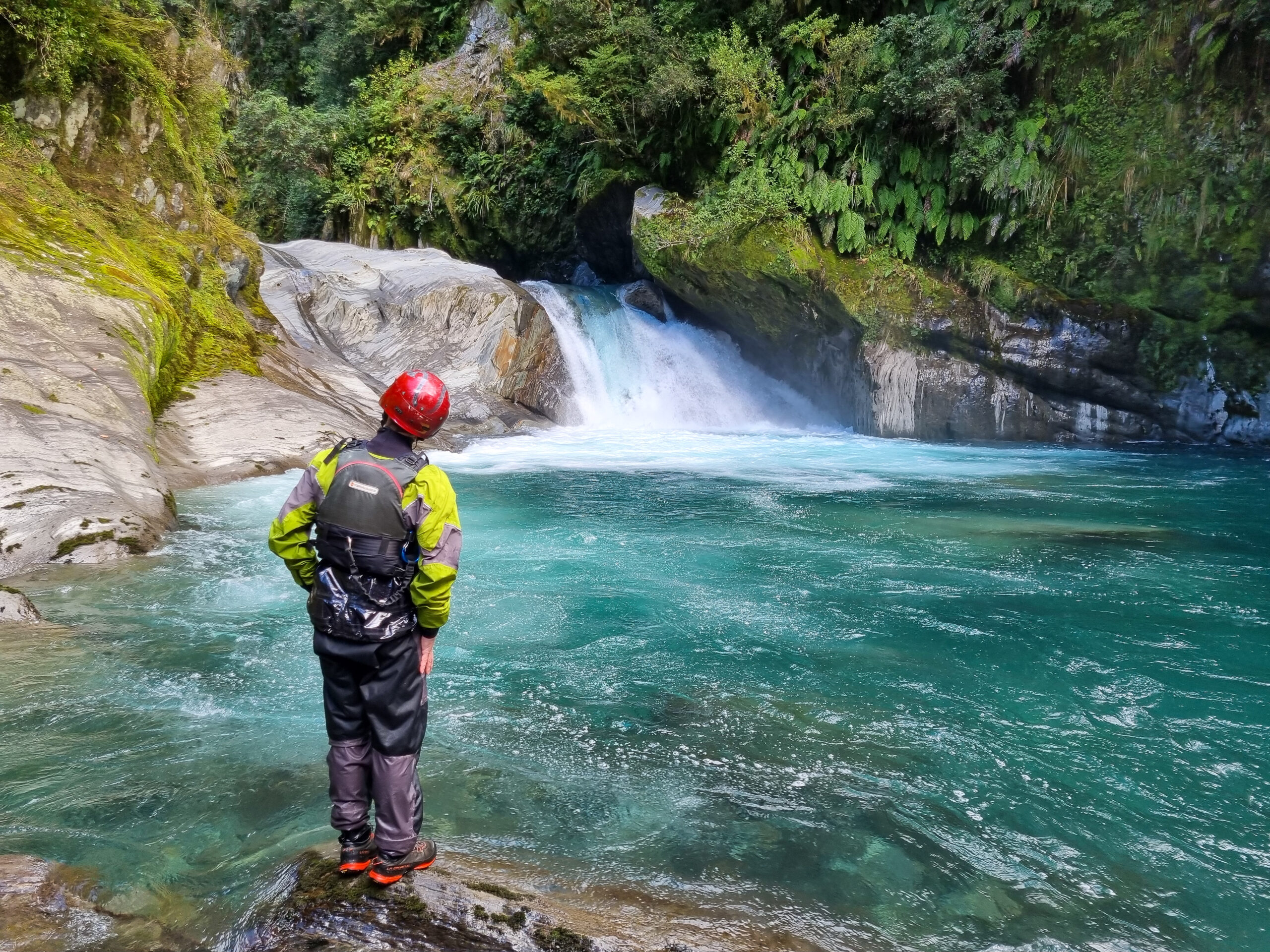
Lower Toaroha – T Canyon exit / Ellis Creek to DOC Track
The pool below the T Canyon waterfall makes for an atmospheric start to the trip. The first drop is a tight 3 m chute followed by a series of smaller chutes and pools in a beautiful canyon setting. The riverbed then opens out into a more boulder garden character that can be navigated with a mix of boat and bank scouting.
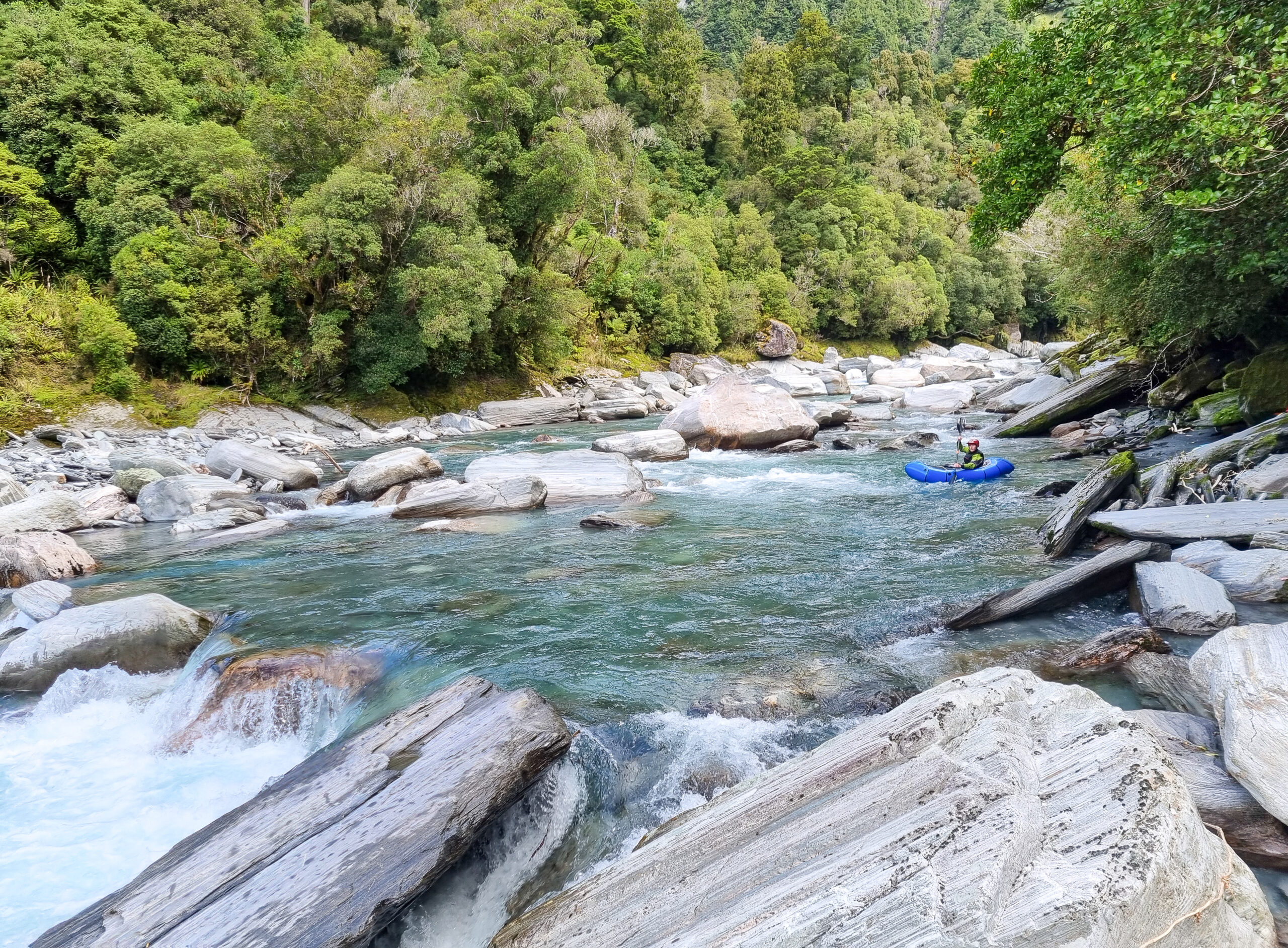
This is followed by a series of steeper bouldery rapids that you will have seen on the walk upstream, including the above mentioned steep boulder chute. Most of these rapids are generally busy with many moves required in quick succession to avoid collision with rocks.
The gradient then eases back in the section around where the walking track emerges from the bush.
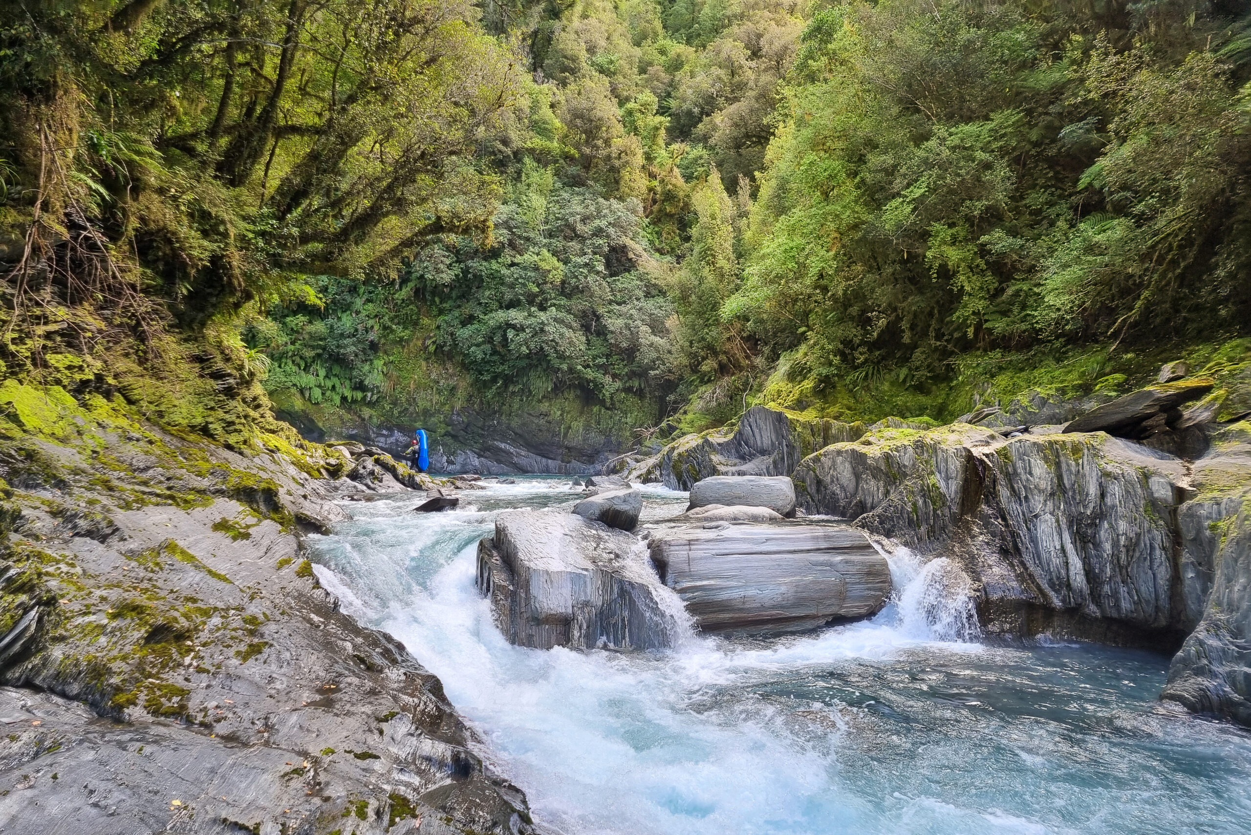
Lower Toaroha – Lower gorge (below the DOC Track)
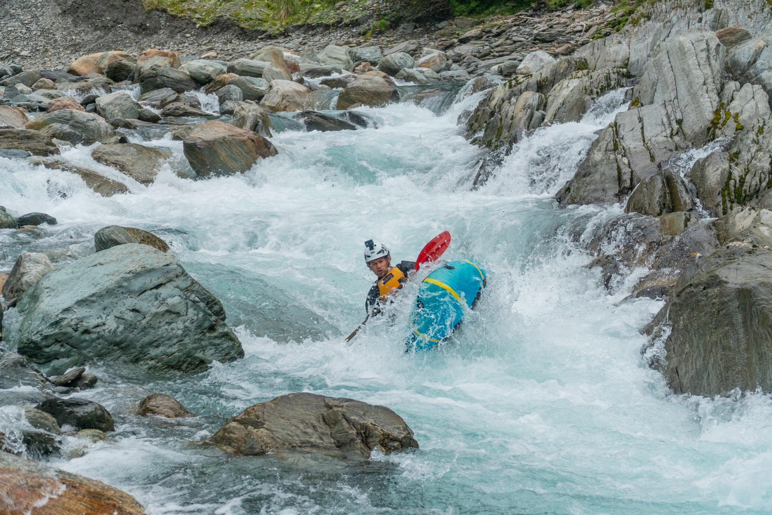
The lower gorge section starts with a few easy boulder gardens that lead into a couple of nice clean drops of 1 -2 m before an obvious right-hand corner looms.
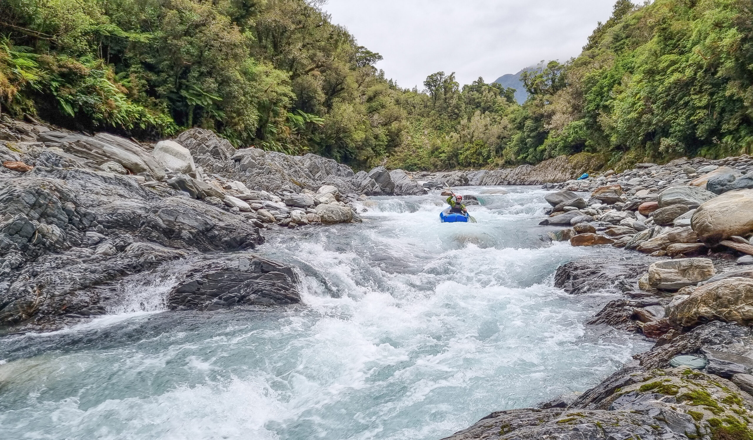
An obvious gradient change marks a longer steeper rapid. This rapid has a wide shallow apron-style entry that feeds water towards the river left. The water then accumulates as the rapid turns to the right and is surprisingly straightforward despite its overall gradient. There is, however, a prominent finger of rock to the left of centre in the lower tongue of water that is best avoided in a packraft, and this is assisted by ensuring that you lay eyes on it as you set up your line through the meat of the rapid. The easiest approach is to enter from river left and then straighten up towards the centre for the lower half. It’s about here that the markedly different geology of fractured sharp rock of the lower gorge starts becoming prominent, with the above-mentioned finger of rock being an example to avoid. With any luck it may well be removed in future flood, but there are plenty of other similar obstacles in the remainder of the run.
Many of the rapids in the rest of the gorge run up against headwalls or otherwise feature lumps of bedrock sitting in the current. Most of these will require bank scouting to determine a suitable line, particularly if unfamiliar with the run. All are easily scouted with straightforward portages if required.
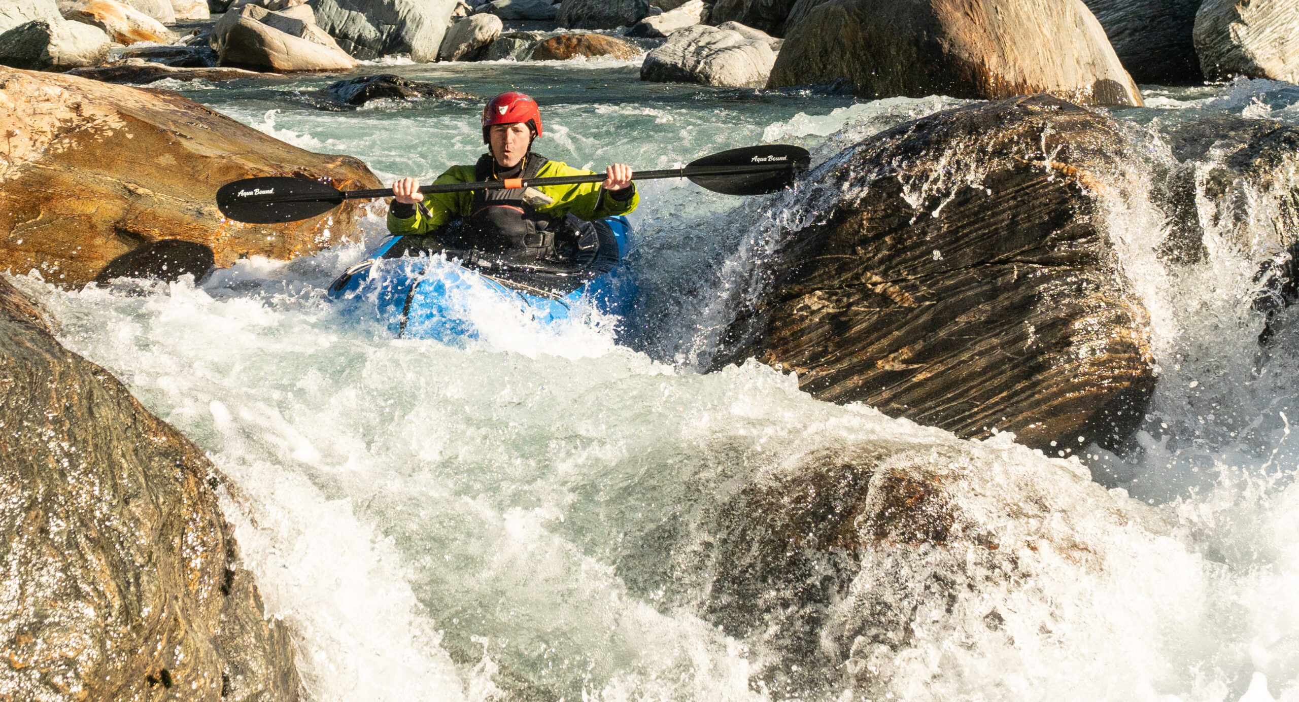
The final sequence of three rapids provide a fantastic finale to run that will see you absorbed in some solid whitewater and deep green pools.
Special mention should be made of the final rapid which features a couple of entry drops leading to a short rocky canyon with an outrageous kicker-style feature sitting midstream in the final drop. In the summer of 2023, we ran this rapid twice. On the second round with slightly lower flows, bank scouting (from the true right) picked up a Y-shaped log positioned vertically in the mushroom of this kicker feature. Thankfully we had not attempted to hit the central line off this feature on the previous run mainly due to the double hole that sits immediately downstream. No doubt this is a fantastic move in a hard-shelled boat but the wood hazard could spell disaster for pack rafters (and similarly for swimmers). With any luck this hazard will find a way to remove itself in the future, but it is very difficult to spot so take a close look and beware of the potential consequences if someone should be pinned or trapped in this position. If running the rapid the easiest alternative line is to the river right but this requires a strong cross-current move above the drop.
This rapid marks the end of the lower gorge from where continuous bouldery grade II water takes you down to the takeout opposite the farm track.