


Overview
A multi-day trip packed with exciting whitewater, dramatic landscapes and strenuous tramping, the Landsborough provides an unforgettable South Westland wilderness adventure for advanced packrafters. Nestled between the glacier clad peaks of the Southern Alps and the Solution Range, this remote trip is a classic for parties fit and competent in New Zealand’s backcountry.
Photos and info by Chris Muse, Nick Ozard and Martin Robertson with additional notes from Greg Duley and Hugh Canard. Additional formatting, approach hike lines and edits by Dan Clearwater
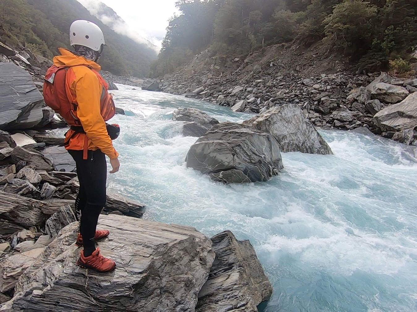
It is no place for the inexperienced, or paddlers who think they are better than they are. At least three people have drowned in the gorge.
The trip is appropriate for people who can paddle grade 4 and make it look easy. There are long continuous rapids with real hazards, so you must be paddling well enough that a swim is unlikely, and if that were to happen your rescue skills must be lightning fast and completely reliable.
The access is challenging, and once you’re in there, you’re in there, with no simple escapes. You must be prepared for some hellish portages (ask Dulkara) if you take the sensible approach and portage what is beyond a Packraft. Be prepared to sit it out for a week if the river comes up and have means of dialing up a chopper if the river/weather doesn’t play ball.
You’ll probably see stories/reports of less experienced folks managing to get lucky and bumble through this trip in super low water conditions. You’ll also probably find stories of fatalities, near misses, epic portages, week long floods and mis-adventure.
Basically:
So if you have any reservations about whether you’ve got the skills and experience to do the trip, either
- Stay away, and go build your skills, or
- Go guided – If you’re close, but not quite at the right skill level, talk to the commercial river runners about joining a rafting trip where you can get advice on lines and can portage safely in a raft.
Disclaimer (quoting Greg Duley)
I would be very dubious running the Landsborough in a Packraft at anything other than low and clear levels without an experienced kayaker running safety – unless the packrafters are very experienced Grade IV+ boaters and very experienced in whitewater rescue. There is the potential for some very long and dangerous swims, let alone loosing gear/paddles. It can be so big and long and fast with any water in it that throw ropes or a Packraft running safety are just too slow and unreliable. The Packraft running safety would have to be right at the bottom of the rapid and that means potentially some very long swims before rescue.
Gauge & flows
The Landsborough itself has no gauge but an approximate level can be calculated by taking 2/3 of the Haast river flow at Roaring Billy.
The photos here show Nick’s trip, after several days of clear weather with flow in the sweet spot of approximately 50 cumecs.
As phone signal is non-existent in the valley a helpful rhyme can be used to judge safe flow levels in summer: “If it’s blue, head on through. If it’s grey stay away!” A local guide notes this rule is good after New Years. Spring melts can give blue water but high flows that make the Grade 4 and 5 untenable in a Packraft. It’s a whole different ball game if there’s any colour in it at all – if there’s been any rain it turns into a Class V nightmare fest – unmanageable in a Packraft.
Getting to the river
The Landsborough has long been a popular commercial rafting and private kayaking trip. These parties fly in to Kea Flat, which is the upstream limit of air access.
The ‘classic’ packrafting route is via Broderick Pass to Ceswick Flat. Keen packrafters can hike up-valley to get more of the difficult water upstream. The Broderick Pass route is accessed from the Lake Ohau Road and is described below.
Groups skilled in packrafting and trans-alpine tramping have used Karangarua Saddle and Elcho Pass to get in higher up the Landsborough. There’s many ways to make the approach as hard as you like…
View Larger Topographic Map
The Broderick Pass walking access route
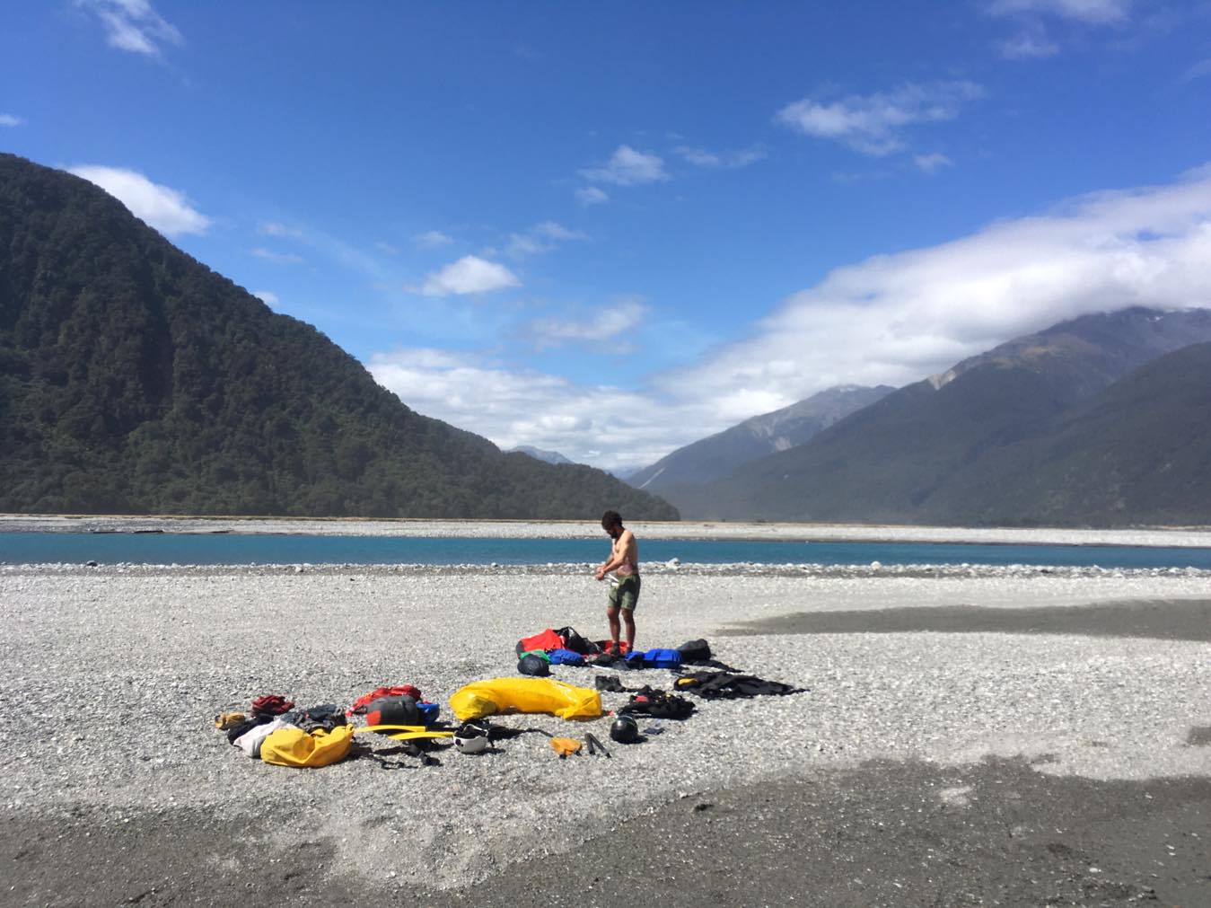
The shuttle
With 260km between Lake Ohau Road’s end and the Landsborough/Haast confluence at Clarke Bluff, the shuttle is extensive. Consider leaving a car in Wanaka and hitchhike both to the road end and from the take out. For those on a tighter schedule a combination of public transport and local shuttle companies may be a solution. Either way, it is a logistical challenge.. Good luck!
Day One: Shuttle to the road end and walk to Monument Hut (3hrs)
With a bit of luck you can hitch all the way to the Temple Stream turnoff beside Lake Ohau. From here it takes three hours to reach Monument Hut on foot. A good 4WD could easily make it all the way to the hut door. The hut offers 6 bunks, legions of mice and a Grade IV toilet.
Day Two: Monument Hut – Brodrick Hut (6hrs)
Follow the well-marked, track up the Hopkins valley and into the Huxley. Once over the Huxley swing bridge, in low water the river bed can occasionally be followed for more direct travel. 3 hours walk through beautiful mountain scenery brings you to the Main Huxley Forks Hut (6 bunk) with its more compact neighbour directly adjacent (3 bunks).
The track then heads up the North Branch of the Huxley. After crossing the swing bridge to the true right as the path is washed out for the most part.
With the river low stick to the river bed on the true right with several channel crossings and boulder hopping. Watch for loose boulders on the slips. Following the cairns, you can ignore the orange snow poles for the most part. When you reach the last creek/tributary before the hut head up the true left of the creek about ten/twenty metres, a cairn marks the point where you rejoin the original track. Climb up the steep bank to come to an orange snow pole at the top then follow the markers through bush to the hut.
Brodrick Hut is a cosy six bunker, a short stroll from mind-blowing views of the upper Huxley Valley. This leg took 3 hours, including stops for white water centric conjecture and rapid evaluation, bringing this up to a 6 hour day.
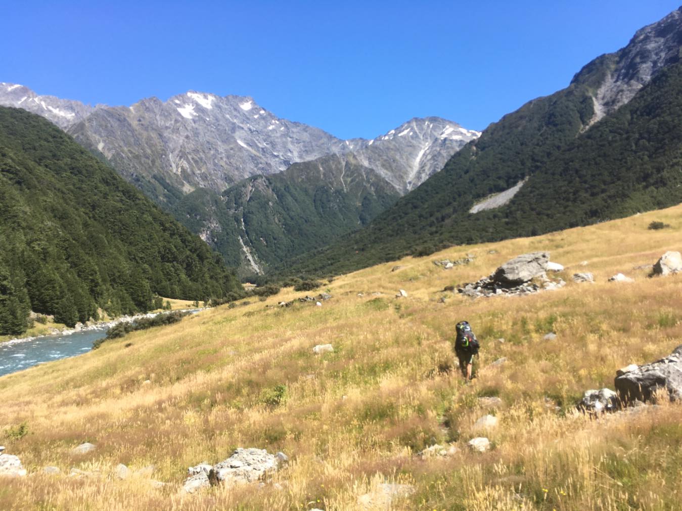
Day 3 Brodrick Hut – Creswicke Flat Hut (7+hrs)
The climb up the pass followed by the steep descent into the Landsborough combined to make this the biggest walking day of the trip.
From the hut head uphill slightly and follow markers and cairns across deep creek beds and along the valley floor towards the foot of the pass. Orange and white markers, snowpoles and cairns lead the way up and over the pass. A fit crew with a good shift on might take two hours from hut to the top of the pass.
Just over the pass the markers end and a couple of cairns lead you down steep snow grass and patches of scree to the top of a cliff. This could be hazardous in wet weather. Head northeast until the cliff eases into the top of the Mackenzie Creek.
From there follow the creek down across patches of scree and alpine grasses. There are sections of boulder hopping and occasional necessary crossings, which were not a problem in dry weather.
The next step is the navigational crux of the trip. It is relatively simple but in the words of navigation advisor Stuart Bilby: if you miss the route “All other roads lead to suffering.”
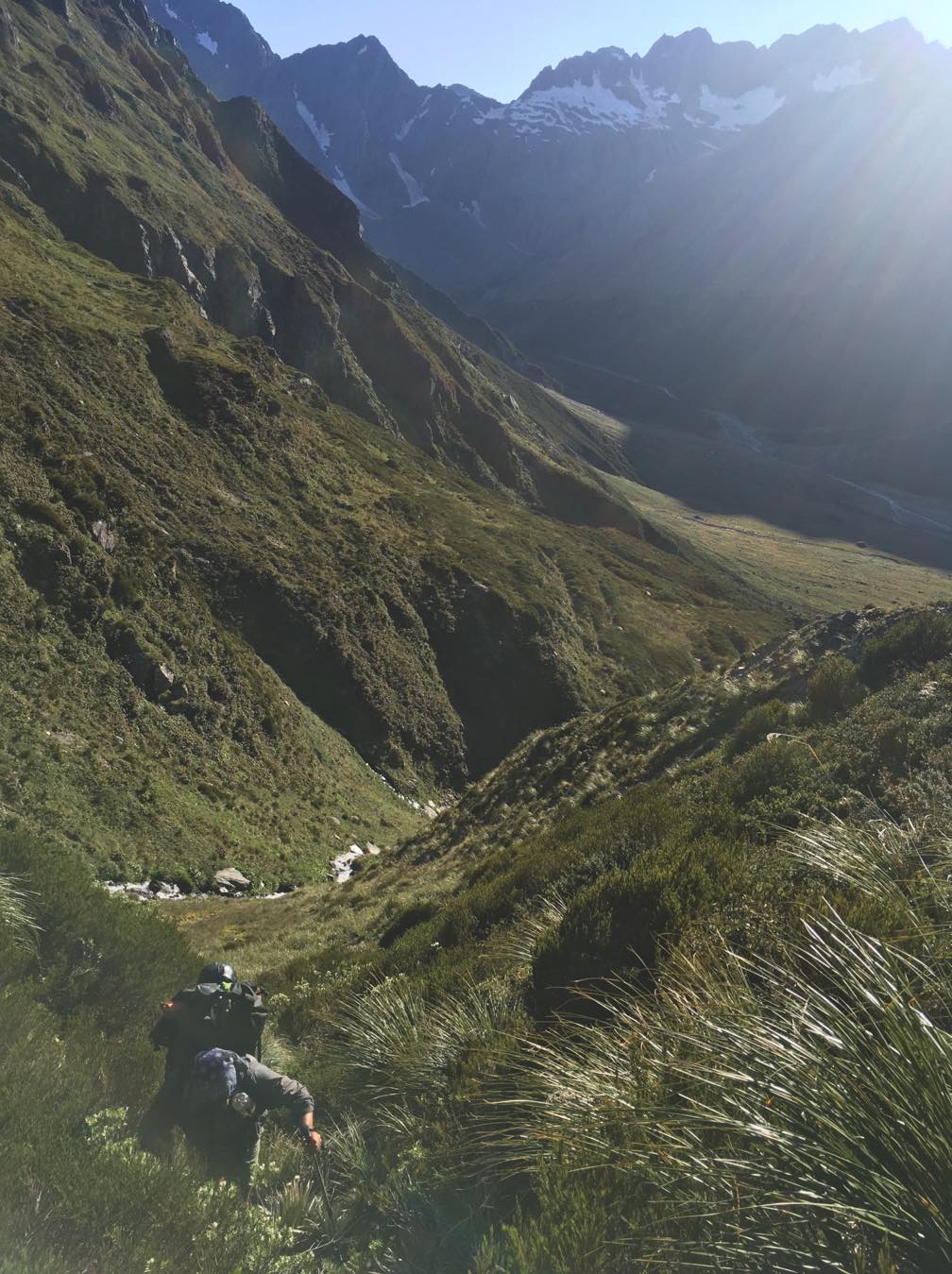
The creek steepens and crosses the scrub line and a small slip becomes visible on the TL. At the upstream base of the slip a strip of orange tape and a cairn mark the start of the climb onto the spur you must descend to the Landsborough (see map). From the pass to the slip takes approximately two hours.
Follow the cairns to the top of the slip where you come to a good camp spot with tonnes of space for multiple tents. Follow orange tape and Permolat against all logic in a direction violently uphill onto the top of the spur.
A well-defined path marked with orange markers descends the spur steeply. Even in bone dry conditions this is slippery as hell. Just above the creek descending west of the spur, the tree rooted track grows steeper before dropping through a patch of ferns to the true right of the creek. Allow at least two hours from the slip to the creek.
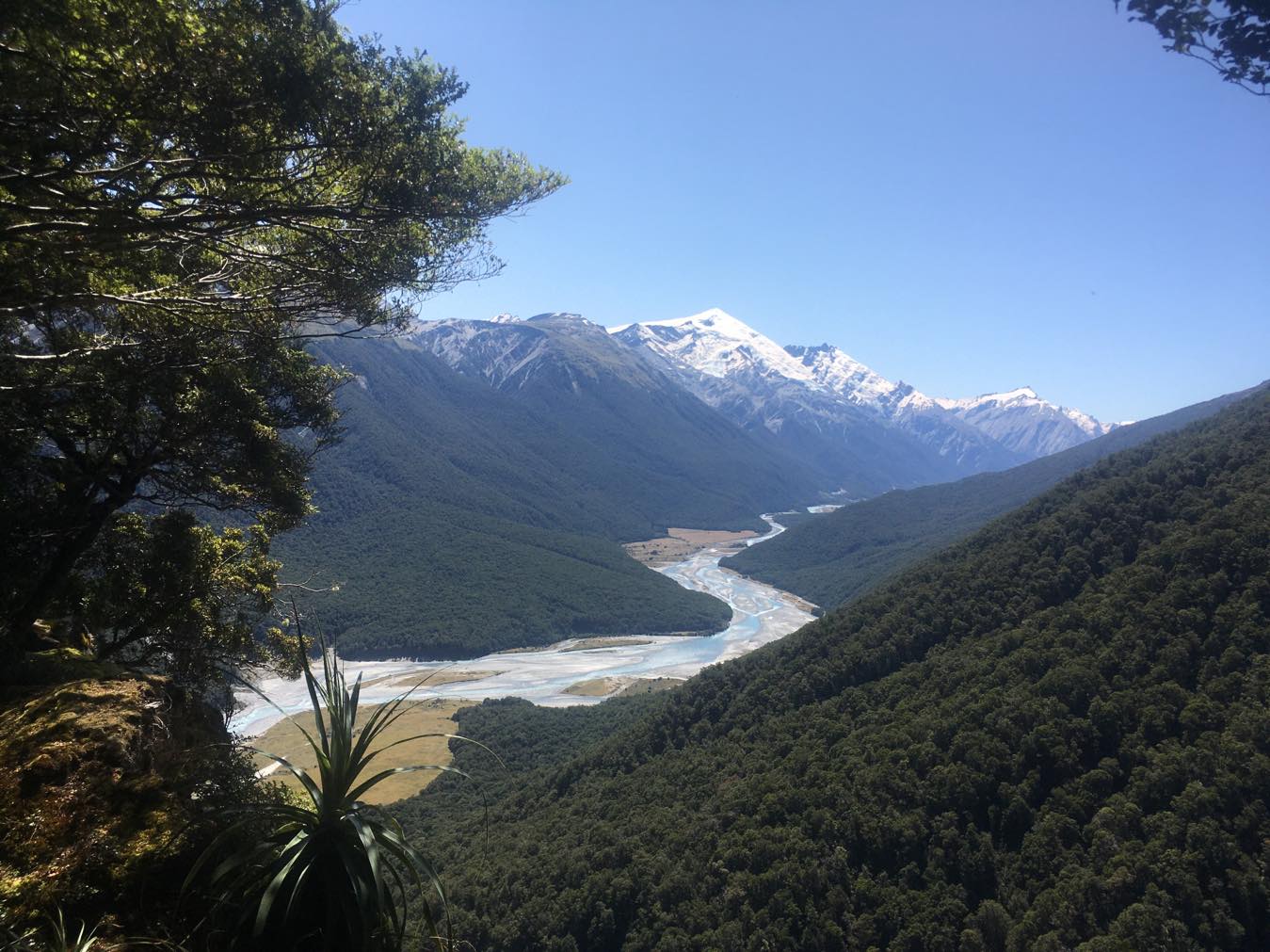
Cross the creek to the True Right and follow orange markers down through open mossy beech forest until the creek fans out as it meets the Landsborough. Cross back to the true right and follow the bush line round until you see the hut. This is a solid day of at least 7 hours at a good pace (Nicks party were pretty buggere). Creswicke Flat Hut is a shiny new, toasty warm, 4 bunker with epic views up the valley
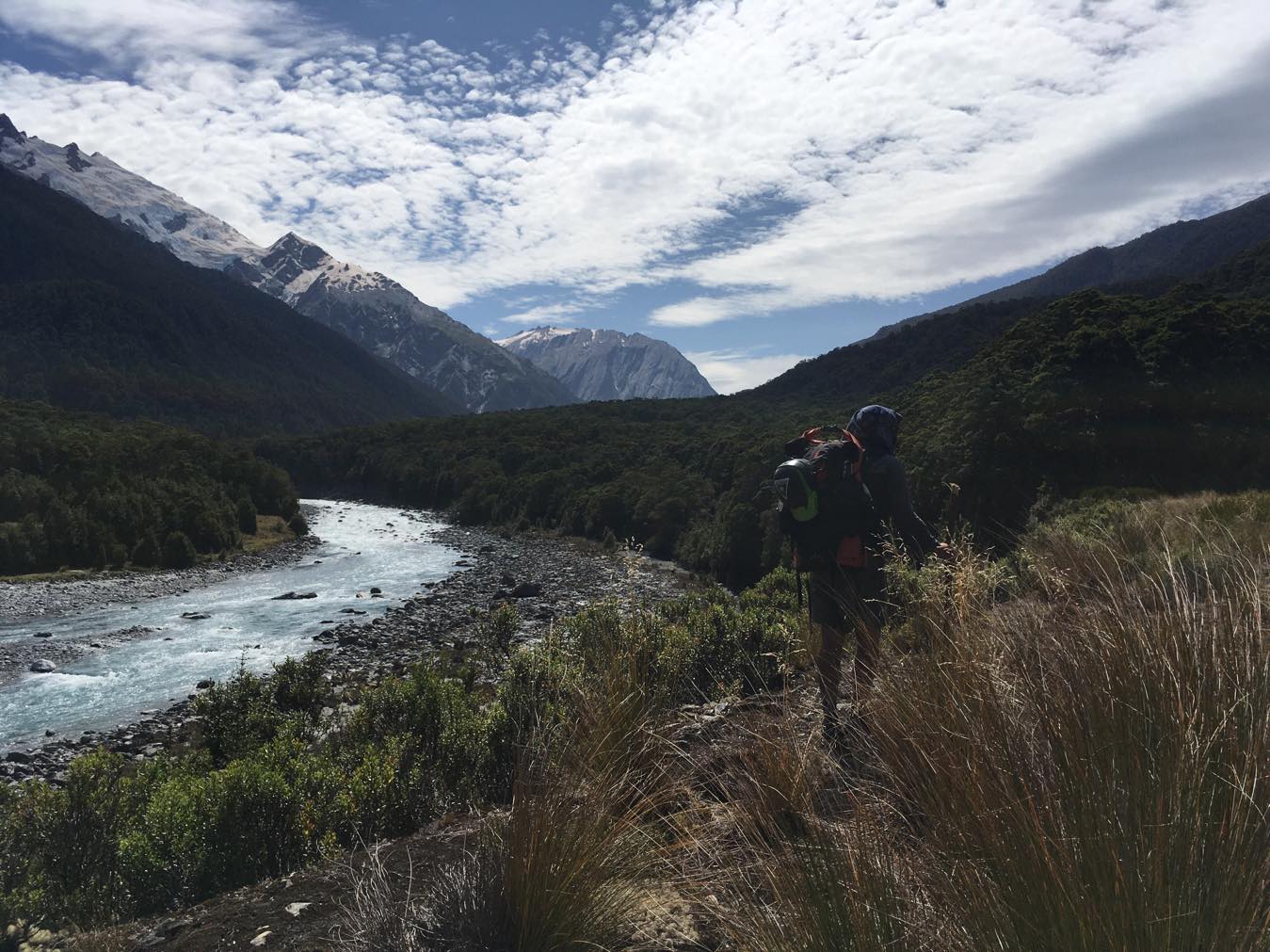
Day 4: Optional hike up to McKerrow Creek put-in (6.5hrs)
This day is an optional extra for additional river running. Plan to head up the Landsborough valley and put on the water around 2 o’clock, giving plenty of time to raft down before sunset.
The route alternates between the river bed and, occasionally, the well-defined and marked trapping route up the true left. The line on the map is indicative only: use your own navigatory discretion. The good news is, you can put on anywhere if its taking too long or its later in the day than ideal..
Allow 6.5 hours of walking to McKerrow Creek, 1km upstream of Kea Flat.
The Landsborough River
The river has been paddled from as high as Zora Canyon (possibly even higher), with class III and IV features, in two main gorges (just below Hinds Flat and above Kea Flat). Packrafters starting at McKerrow Creek, makes for a good ‘warm up’ on II/III/III+ water, leaving the bigger stuff for the following day.
Check out Mark Oates’ video, putting on at Zora Creek…
Day 4. McKerrow Creek – Creswicke Flat (II/III+ 3-4hrs)
The water from McKerrow Creek back to Creswicke flat is a mix of continuous Class II rapids, with Class III boulder gardens, large wave trains and occasional Class III+ features. Orange Roughy (III+) is above Toetoe Flat, and Christopher Columbus (III+) above Creswick Flat.
It’s essential to scout anything you can’t see clearly. For this stretch allow 3.5 hours.

Day 5 Creswicke Flat – Clarke Bluff (II/III/IV- or V in high flows)
From Creswicke Flat Hut, the water contains consistent class II in between stout class III/IV- boulder gardens before entering the Upper Gates Gorge.
The Upper Gates Gorge, between Golden Point and Harper Bluff, is the crux of the trip. Its heads up boating and consistently scouting every horizon is a must.
Unless its a biblical flood, all rapids are portageable with varying degrees of boulder hopping.
Greg Duley explains some of the named rapids and packrafting considerations in the Upper Gates Gorge..
“Near the start, The Squeeze contains Bermuda Triangle, Stoat Trap and Rib Cage, which would be very tough in coloured/higher flows in a packraft.
Then you’ve got the Class V Hellfire and Brimstone, with the big boulder B12 that forms a big hole at the bottom, then Whizza’s Mistake and last Double Brown.
The Upper Gates Gorge can be Class IV+ to Class V in a packraft unless low water levels. Bermuda and Stoat Trap rate as possibly the toughest in a Packraft as you need to be spot on the right line which changes during the rapid and its very, very hard to move a Packraft quick enough to get on line in that big water. A spill in Bermuda which is quite on the cards because of how fast the main current takes you into that large triangular rock means a very unpleasant swim through Stoat Trap and Rib Cage. And that hole at the bottom of the Stoat Trap is a Packraft killer due to the zigzag you’ve had to do just above it which bounces you sideways into it.
The rest of the gorge is manageable for a Class IV boater as while the water and features are big, the manoeuvres are within the capabilities of a competent packrafter.”
Take a look at this video, which gives names to some of the rapids in this section…
After clearing Harper’s Bluff, the river eases into read and run Class II/II+ water.
Below Strutt Bluff, the river is braided, with a few minor rapids to catch you if you aren’t paying attention. The afternoon valley winds can come in pretty strong here: enough to blow you upstream or even loose your boat if they are really strong.
The normal take-out option is by Clarke Bluff. 400 meters south on Highway there’s a lay by suitable for shuttle parking or hitchhiking.
If you’re after the source to sea experience, you can carry on down the class I/II Haast River, but watch out for those headwinds… The Hard Antler Pub in Haast is a great place for a well earned drink and feed!
A few final thoughts
In the NZ Hunter Episode on the Landsborough, Greg Duley (despite training in advanced whitewater and extensive Grade IV packrafting experience before the mission) had one of their team running safety in a kayak.
KC is an extremely experienced kayaker, and also the most experienced Landsborough guide. If you don’t have an experienced kayaker in your crew who can run safety, especially in the Upper Gates Gorge – hire a guide! It’s only fun if you survive!
We ummed and ahhed about publishing this trip report because we don’t want to encourage anyone onto this river that isn’t fully capable of the respect it demands. Please take the advice of the collective wisdom that Martin Robertson consulted on this trip write up. FIRST TIME HIRE A GUIDE!