This wild and remote epic through East Cape country is one of the top multi-day Packrafting trips in the North Island. It flows through spectacular dense forest and gorgy scenery. It is a popular rafting trip particularly with hunters who also utilise jet boats for access.
The Motu River is the premier whitewater wilderness trip in the North Island. With lower summer flows the gorges are mostly Class III but with winter flows you can expect a Class IV trip. With high flows Class V water will be found. We found a new slip before our trip had created a nasty (and sharp) Class IV rapid that needed to be portaged and it is evident that this could occur at any time due to the steepness of the valley walls. The rockfall was still highly unstable so beware.
The country around the Raukumara range, through which the river flows, is mountainous remote and difficult. It was the last area in the country to be mapped. Only the most experienced Packrafter‘s should consider this trip under anything but summer flows.
History
Māori
The Motu River lies in the ancestral lands of the East Coast Ancestor, Apanui Ringamutu. In this blog post on Wilderlife.nz, Blair ‘Jah Lion’ Trotman, with consultation from local hāpu representative Louis Rāpihana, shares the rich history of the Motu Awa and how its current kaitiaki (guardians) continue to care for the river today.
Pakeha
In the 1970s the Motu narrowly escaped becoming a couple of large hydro Lakes! It was evaluated for hydro potential by the Ministry of Works. Several dam sites were investigated and a road pushed in to Otipi. However, the significance of the rivers wilderness features and recreational value was recognized and in 1982 the Queen Elizabeth II National Trust applied for a water conservation order. The National Water Conservation (Motu River) Order 1984 protects the river in perpetuity.
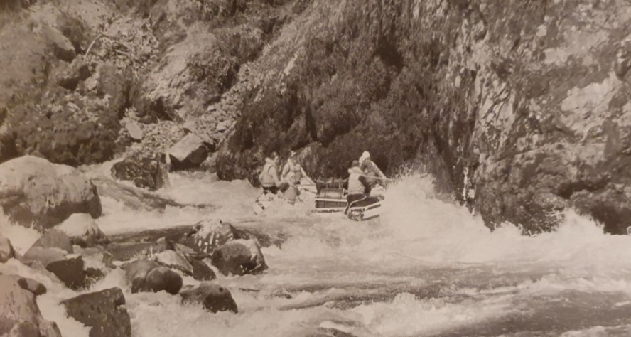
An Epic Wall Rapid now called Sonny’s Revenge (Photo Egarr)
By Road
The shuttle is long and difficult and cars should not be left at the Road ends – arrange a shuttle with a local shuttle company
To get to the put in drive south from Opotiki on the State Highway through the Waioeka gorge to Matawai (north of Gisborne). Take the Motu Road, which turns off the main highway at Matawai, which becomes Motu Falls Road. Go as far down the road as possible along the right bank to Waitangirua station (get permission first). It is possible to put in below the falls but most trips put in as far down as they can to avoid a fairly uneventful stretch of river. At the Farm gate the public road ends but the farm track is a paper road and Motu Trails were able to drop us at the “Ford” put-in.
To get to the take out drive east from Opotiki on State Highway 35 (approximately 44 km) to the Motu Road bridge the usual take out is on River right under the bridge. Do not leave the vehicles at either road end – arrange a shuffle with Motu Trails 027 505 2120.
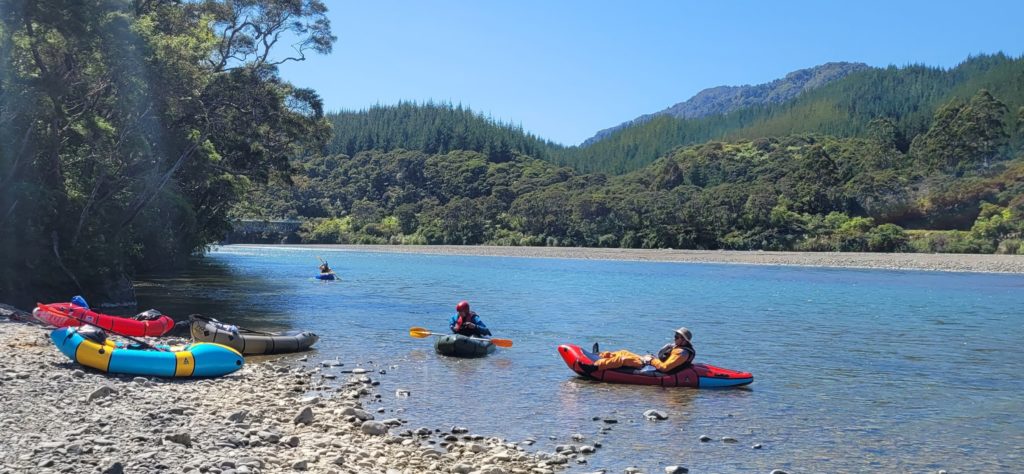
On Foot
To make this a packrafting trip (rather than a road to road through-trip) it is possible to walk in on the Otipi Hydro Road. the drawback is you miss the Upper gorge. There are various wilderness routes into the river. There is very good google earth imagery in Google Earth Pro. Carry an In-Reach and familiarise yourself with the emergency exit options – they are limited!
On the River
The Motu flows out of the hills to cross the main Opotiki Gisborne highway at Matawai. The river is small and uninteresting until it reaches a series of bedrock ledges at Waitangirua. Motu Falls is an eight meter waterfall comprising a number of rock ledges.
The usual “Motu trip” is to put onto the river below the Falls near midday after arranging the shuttle. The paddling can then be completed in three days but most parties allow five days as a contingency for wet weather. Some trips have taken 10 days due to floods.
Usual trip plan
- Day 1 run shuttles (up to 2 hrs form Opotiki) and paddle easy water to camp opposite Blue Slip above the top gorge (18.4km)
- Day 2 run the challenging top gorge (19.4km) and camp at Otipi 4wd road end (not currently accessible even by quads) or on the easy reach downstream or at or below Mangakirikiri hut (another 5 to 10km).
- Day 3 finish the easy middle reach and then run the challenging steep bouldery rapids of the lower gorge to Te Kahika Stream (9km). Then camp or paddle on to a small campsite on river right below Whites Rapid (where you could meet a jet boat to cheat the last 20km of easy water and potential headwinds).
- Day 4 paddle easy water from Te Kahika Camp (31km) or Whites camp (20km) out to the State Highway
- Day 5 Camp / hunting / wet weather contingency day
Day 1
From Motu Falls to Kirks Clearing the river is shallow and easy with some tight rocky Class II water. The first day is usually aiming for a campsite above the upper gorge. The bedrock in this part of the river forms lots of little ledges and rock rapids but nothing challenging.
There is a camp in the bush opposite Blue Slip, don’t go past it as there is no camping in the gorge. Camp the first night above the gorge will give a full day to complete the gorge. You must allow a full day for the gorge as many rapids require scouting and you may need time for scouting and even incident management (swimmers, sharp-rock induced boat repairs or injuries).
Day 2
The upper gorge rapids comprise tight short drops among sharp angled greywacke bedrock. These rapids have a tendency to collect wood hazards. Take your time and scout diligently! In low flows remember these sharp rocks can slice packrafts. Don’t enter the gorge in rain or a rising river as it is long and has limited scope for camping (virtually no scope when in flood).
The first notable rapid in the upper gorge is below Otipi stream a fairly straightforward rock dodge. The character then changes to a steep pool-drop through a steep-walled bedrock gorge. There are lots of horizon lines and potential for logs.
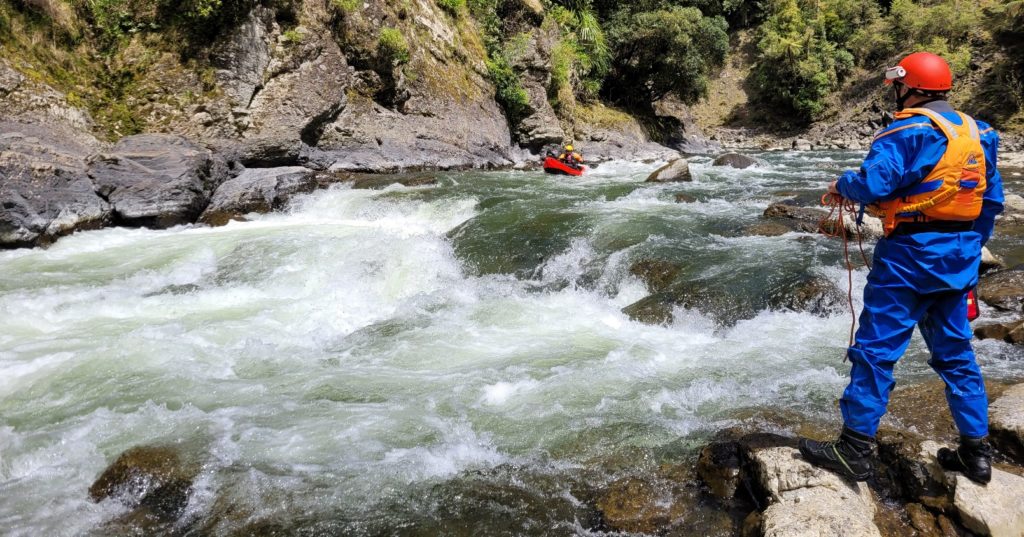
A number of difficult rapids culminate in Bullivant’s Cascade (named after Kahu Bullivant who lead an early trip down and swam this rapid). It is a long narrow channel between rock walls with a series of drops. It ends with the river slamming into the wall at the bottom where the river swings left.
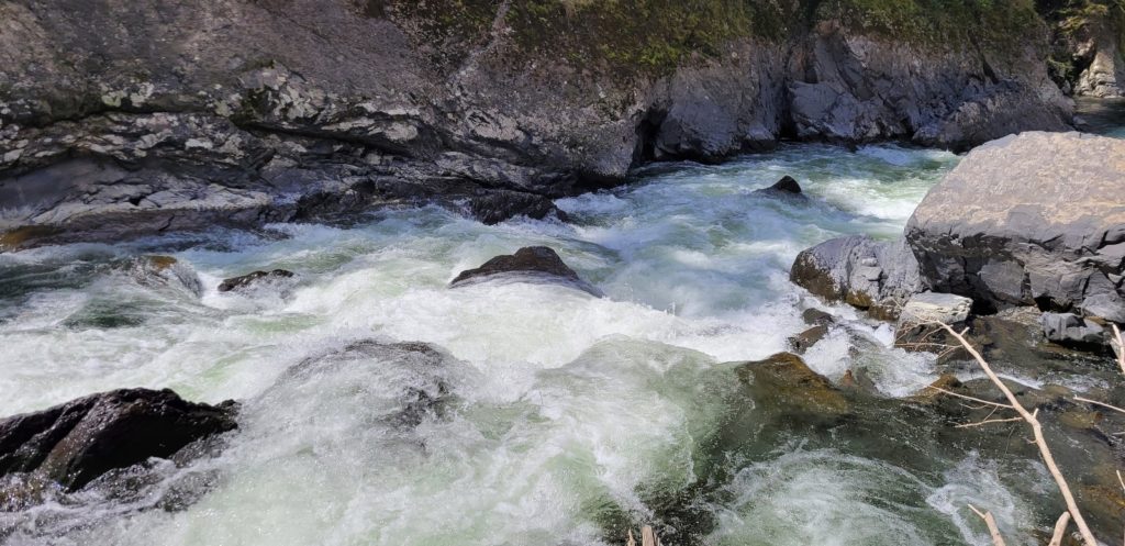
A large slip feeds a pair of solid rapids which we called New Slip (Class IV) and Old Slip. New slip contained large slip debris that was very unstable and angular (see gnarly rocks in foreground above). It is possible that it is more straightforward at higher flow when a channel down the left opens up.
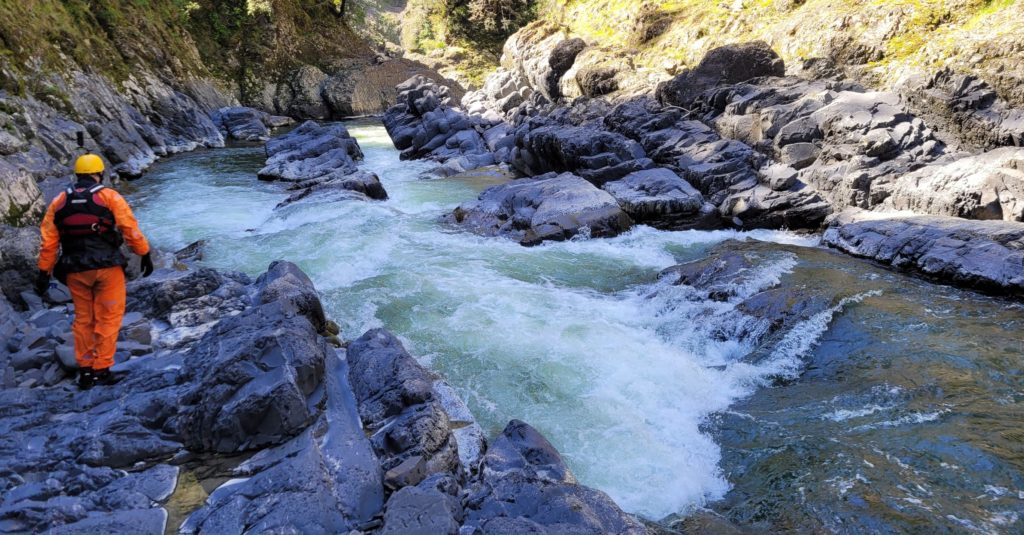
Immediately above the Mangaotane confluence lies the best known rapid in this gorge – the Motu Slot. The slot is a long bedrock channel with low walls. It is little more than 2 m wide and drops through a series of waves. There are two channels but the current favours the narrower right channel. Scout the rapid meticulously for logs. The left-hand slot provides a route which is easier except where it rejoins the river below the slot via a steep drop which may have logs. At lower flows it is hard to get into the left channel. Portage is easy river right – scout it and then walk back upstream and ferry glide across to set safety or portage.
Again – there are virtually no campsites within the gorge and lots of scouting and possibly even boat repairs to slow you down – so allow the full day for this gorge.
From the Mangaotane, the rapids ease as the best of the gorge is over. This easier Mangaotane gorge is really just an extension of the upper gorge. It has some of the steepest gorge walls you will see in the country due to the less fractured bedrock. You can see why the hydro engineers got excited about a dam site here!
There are a number of bouldery rapids before the Otipi hydro road including Egarr’s “Nasty” Rapid. Nasty rapid II was known as the Graveyard because it featured a few broken kayaks when it was at peak nastiness. Note Nasty I doesn’t seem to be of any consequence (it must have mellowed /disappeared).
Depending on how long you took scouting in the gorge you can camp where the Otipi 4wd hydro access road meets the river. There is even a long drop a short walk up the road!
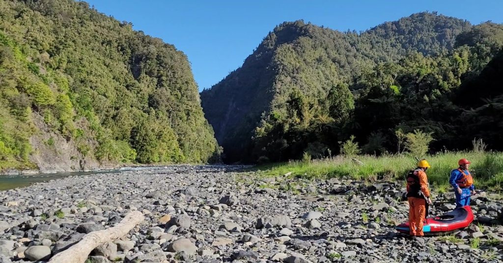
If you have time you can push on. There are still rapids but nothing of note other than Egarr’s “Nasty III” rapid which is a kilometre after Otipi road after a right hand corner where there are a number of spectacular waterfalls. There are a few rapids down to the Takaputahi confluence.
There are reported to be nice campsites in the vicinity of the confluence (we didn’t see any but have a look). But push on a little (unless you have a day up your sleeve).
Below the Takaputahi there are only minor rapids through a much wider river valley. Camp options will depend on your timeline. Te Paku Gorge is a short and narrow sawcut gorge with deep slow moving sections of water. The valley then opens out again down to the Mangakirikiri stream where there is a hut 15 minutes up the creek.
The river remains easy until the entrance to the lower gorge a few km below Waireae stream.
If you haven’t chosen a campsite stop at the Maihewai confluence or the next major stream (before the river closes in and swings right). From Otipi to the lower gorge is 19km – if you have time it can be good to float some of these away to have fresher arms for the gorge.
Day 3
Having camped somewhere between Otipi and the Maihewai paddle the easy water to the lower gorge. This gorge is only five km in length but contains the hardest rapids in the river. The rapids have a boulder garden character with very large boulders in places – making portaging possible but a nuisance. So allow plenty of time. Again, do not enter this gorge unless you have plenty of time and daylight for scouting and portaging. The main rapids in the gorge are so steep that you cannot see the run out from the entrance and they will need to be shore scouted and routes planned. If you see a horizon line get out. – i.e. most rapids MUST be shore scouted. At low flows the big boulders provide impact and sieve potential. If in doubt walk!
The first of the big rapids is known as Sonny’s Revenge the river rattles over a boulder bank and slams into the bluff as the river swings right. Charles seems to call this one the Hump though Egarr located that further upstream. We’ll go with Sonny’s Revenge because it’s on the topo map.
There is a a quiet section and then Boulder Rapid – this is a very steep boulder bank style rapid that needs to be shore scouted. This is followed by the Shute where a boulder bank creates a shute on river right along a rock wall.
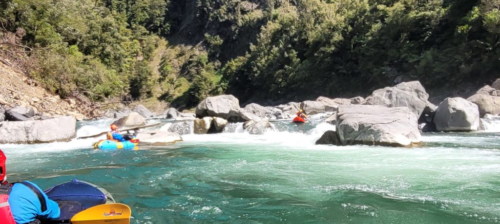
The Double Staircase rapids follow. Upper Staircase is a long boulder garden rapid which needs to be carefully scouted for undercuts, sieves and log – from both river left and right.
The steeper Lower Staircase is another boulder bank. At lower flows the only option is river right but the series of boulder drops are rocky. and can only be scouted from river left. It can be portaged or inspected from the left bank. The route will be obvious if there is enough water.
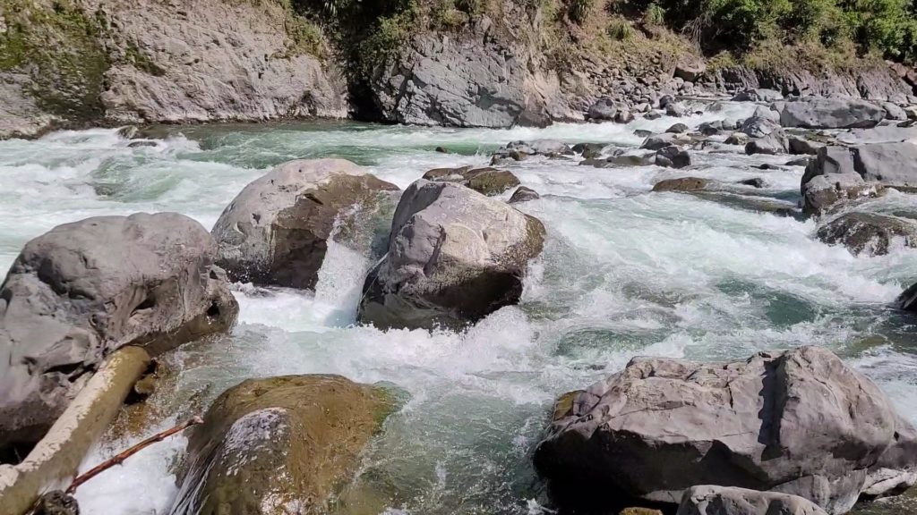
The next rapid is an unnamed steep boulder bank.
The last rapid in the gorge is the Helicopter rapid, named after helicopter wreckage that was visible in the rapid in the 1970s or 80s. A rocky start lines you up for a massive wave train towards a bluff – one of our crew got airborne!
There is an excellent campsite upstream at the Te Kahika confluence (only 9km below the last camp upstream of the gorge).
The alternative, for a shorter duration trip, is to push on (another 11km) to a campsite on a right hand bend below Whites Rapid. Jet boats can access this location for a pick up except in the lowest summer autumn flows.
Day 4
From the Te Kahika confluence it is easy Class II for 31km to the State Highway bridge take out. That is 20 km from the Camp below Whites. On-shore sea breezes blow upstream and pick up in the afternoon and the river gradient is gentle. This means an early start may be smart to avoid the grief of a strong headwind.
Day 5
This is an obligatory camp day to insert anywhere in the trip. Practice lighting fire with wet wood whilst watching a raging torrent and wondering when it will subside! Or go for a hunt and shoot a goat or pig for some slow campfire cooked wild food!
The Gauge
The gauge is here but is well upstream of the put-in when it is 1m3 on this gauge it may be 3 or more at the put-in. There is a gauge at the take-out bridge and this needs to be above 15 for the entire trip (i.e 15 and falling won’t be much fun) At 25 the gorges are boisterous in a packraft at higher flows take care!
Portaging of rapids is not a problem unless the river is in flood and the riverbanks are covered. Camping is problematic in flood events so take an In-Reach and stay on top of weather forecasts before entering either of the gorges.
View Larger Topographic Map


