This hard to get to and hard to time remote experience is one of the North Islands best-kept secrets. From tussock covered desert plateau to beech forest, to scrub and high country sheep station it has so much scenery packed in. It is also one of our premier trout fisheries and is protected by a Water Conservation Order. It has some epic water but everything can be portaged.
The write-up draws on forum comments and trips reports by Chris Bailey, Greg Duley and Thor Tingey and a description by River Valley.
Suggested Trip Plan
Day 1 – A long afternoon
Walk Desert Road to Maowhango Camp 5-7 hours 12 km
Day 2 – Maowhango to Makomiko Camp
Walk Camp to Otumateanui stream 5 hours 9 km
Walking the Dog/ Float the Boat 3 hours (incl prep boats) 3km
To Otumateanui Makomiko camp
Day 3 – Makomiko to Wangakia Camp
Makomiko to Rangitikei 4.5km
Otumateanui confluence to Waingakia 9 km
Day 4 – Big Day Out
Waingakia to Pinnacle Chute 3.5km
Pinnacle Chute 1km
Pinnacle Stream (NZDF Boundary) 3km
Pinnacle Stream to Otarere Gorge 7.5 km
Otarere Gorge 3km
Bare Acre to Erewhon 7.5km
Boomer Rapids 1.5km
Springvale cruise 6.5km
Consider booking River Cottage where cars can be left at the take-out. River Valley Lodge will help with shuttles for a fee.
On Foot
The most common route to the Rangitikei is off the Desert Road via the Southern Access corridor poled route. The first day is 12kms across tussock tops to a pleasant campsite on the Maowhango river (Camp on true left for dry feet in the morning). The second day is to get a further 9km over the last range of tops and down to the Otamateanui. The trail down to the Otamateanui stream is well marked. (There are nice campsites just inside the bush edge if you aim for this spot on day one).
Once at the stream, blow up boats and walk them / float them down the stream. Be prepared to lower boats over some drops and take a leap of faith here and there.
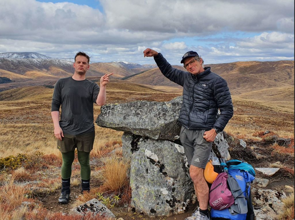
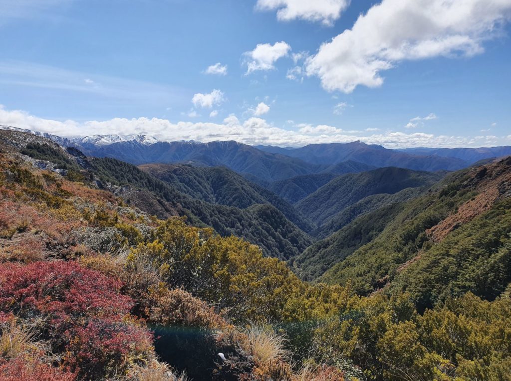
(Alternative Thunderbolt route is on skyline)
An alternative route, with much more vertical, is a 2-day walk from Kaimanawa road to Waipakahi Hut and over the Middle Range to the Rangitikei Remote Experience Zone (REZ). This is a tougher route that involves finding a ridge down to the river from high point 1660 (Greg Duley’s NZ Hunter route) or travelling south to Thunderbolt and beyond. Hunting forum members suggest taking the gully directly down from the saddle south of Thunderbolt. Old Kaimanawa Forest Park maps indicate a route over 1656 and 1498 (well marked in 2020). This route means you miss out on the fun of descending the Otumateanui stream. Most will opt for the Southern corridor route for this reason.
Helisika, who manage a lot of private Maori land in the area, will not drop packrafters or paddlers on the upper Rangitikei to avoid inevitable conflicts. DOC may also limit the number of people in the REZ at any time. Avoid the April – May Sika roar period and the start of the trout fishing season in October. There are further notes on land tenure below.
On the Water
Overall the river is 42 km of Class II-II+ or III pool drop rapids with one big Grade IV (Pinnacle Chute) in the top half and one Grade IV (Boomer rapids) sequence at the bottom. At low flows, some drops won’t be runnable.
Otamateanui Reach
If the flow is up there are some tight fun and drops in the small stream. However, you won’t have much of an opportunity to float at typical (low) flows. It’s harder to walk, so put in, float the pools, and “walk the dog” through the riffles. In normal flows, it’s a half-day to the Makomiko campsite.
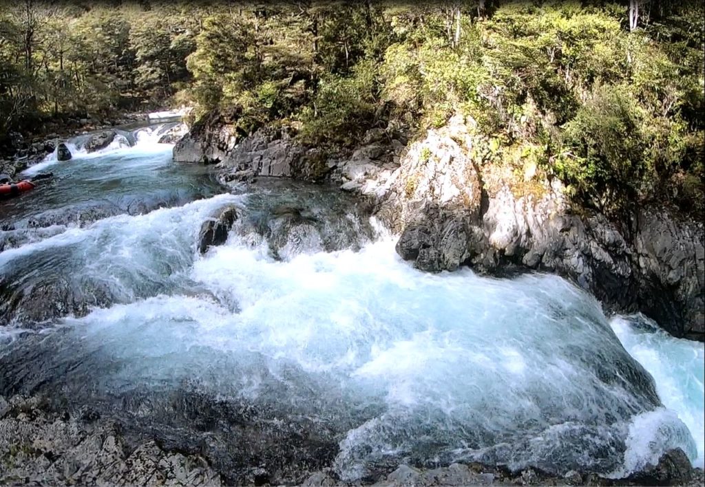
The crux of the Otamateanui is about 500m down from the start where the stream drops through a mini gorge for 400m. There is an abundance of wood so you must scout everything. The first set of 3 drops (Triple Dipper) is great fun in the boat with each consecutive drop getting larger. Scout the whole sequence (including the compulsory portage below the third drop) before getting back in your boat. Set a safety person and a gear recovery person and eddy out after the third drop to execute your portage plan for the Leap of Faith rapid.
The Leap of Faith is a substantial waterfall chute that at high flow slams into a jutting out rock. The risk is high and it’s not worth running. It is also an easy place for wood to hang up unseen in the whitewater. It cliffs out on both sides so the best option is to drag the boats across the ledge on river right and then lower the gear down to a swimmer for recovery.
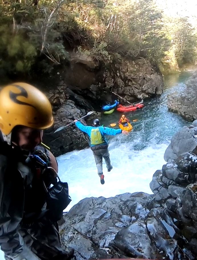
At high flow, it is worse because the exit chute is very aerated and the “Leap of Faith” off the cliff has you landing in aerated foam with shallow rocks. Think it through before taking the leap. A throw rope supported climb is smarter.
Shortly after the Leap is the Coin Slot Drop which may be runnable at low flows but at high flow is a portage.
The Makomiko camp is reached after 2 km of pleasant II+ paddling. It is an established hunters camp on the true right of Makomiko Stream. Due to access restriction, the next day is a short one so it is best to camp here rather than rushing through to the Rangitikei confluence campsite.
River Day 2 (trip day 3) Rangitikei to Waingakia
Paddle on down the Otamatenui to the confluence with the Rangitikei. This 4.5km fetch of Class II to II+ should be easier paddling as the Makomiko contributes a decent boost to the streamflow. In less than 2 hours you should hit the Rangitikei.
The Mangamaire Reach is only 9 km of Class II and runs from the Otamateanui / Rangitikei confluence down past the Mangamaire to the Waingakia confluence. There is a private campsite at Mangamaire Junction which is popular with hunters in the roar. Camp on Rangitikei river left (on DOC land) on a small terrace.
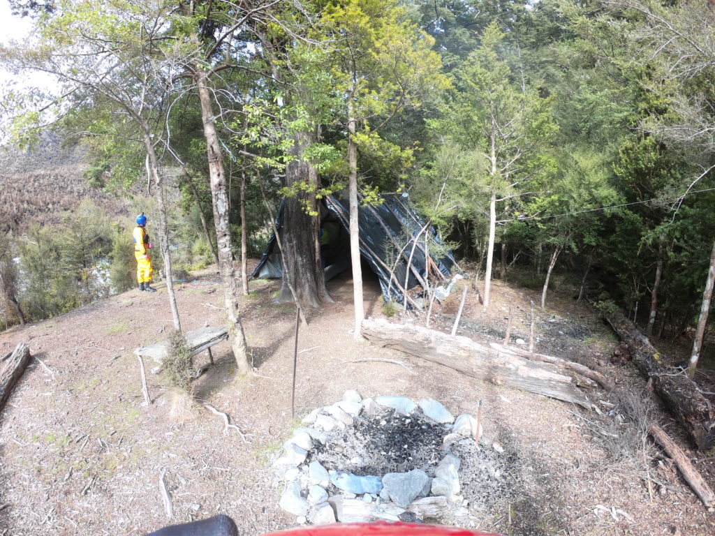
There is (as of 2020) a large A-frame tarp bivvy and room for a few tents and hammocks. The river right bank is all Defense Force, and then private, land. Below the Waingakia the river left land is Ngamatea Station with no camping allowed.
Due to these access restrictions, you need to commit to a huge last days paddle. Allowing time for some Class IV beatering or portage.
Note that The Remote Experience Zone upstream of the Otamatenui confluence is Class I – II and will often have insufficient water. Greg Duley entered the river below Rangitikei Bivvie (private) from the Thunderbolt tops. On our trip in 2020 a hardy crew came over Thunderbolt and down the old Trick Creek Track.
The Pinnacles Reach
Given there is no camping below Waingakia stream you’ll need to make an early start for a big day all the way (33km) thru to the Springvale bridge. It’s important to have decent river flows to help push you through in a reasonable time. There is a lot of scouting and possible portages so don’t underestimate the length of this day. This is another good reason to book River Cottage at the take-out.

The spectacular Pinnacles dominate the skyline on this reach. After 2km of Class II the pace picks up a bit with some decent rapids for a kilometre. The first of these is the Class IV, Pinnacle Chute. It s a straight forward line but has hazards either side of the must make line. Hint – walking it is easy. The last rapid in the Pinnacle sequence is the rollicking Proud Mary Class III that keeps on rolling.
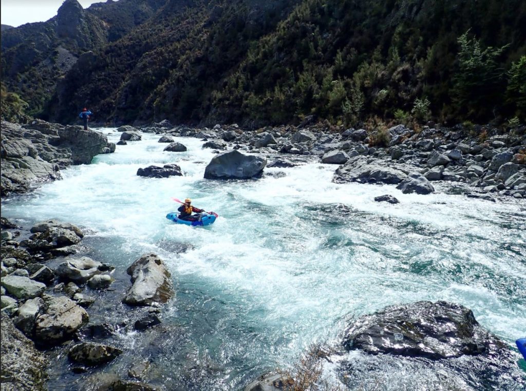
Then it’s back to cruisy Class II for a further 3km to the NZDF upstream boundary at Pinnacle Stream. Lunch on the river. There is no legal access to the riverbank. Having “navigated” the river in your “raft” you will no doubt regard the bed of the river as Crown land under the 1903 Coal Act (and subsequent amendments). Landowners adjacent to the river may feel they have ownership rights to the centreline of the river (usque ad medium filum aquae (AMF) rights). A common law right of passage over navigable water exists regardless. Be polite if challenged and respect the landowners’ rights. Glide past trout fishermen with as little disturbance as possible and don’t access the private land beside the river.
After another 6km of cruisy Class II, you pass “the Gates”. The Gates, a spectacular vertical greywacke band cut by the river, signal the imminent arrival of Egarr’s “Turkey Gorge’ (which may be better referred to as the “Otarere Gorge”) a few km downstream. Despite the prevalence of little terraces boxed in by the gorge walls, camping is not permitted on the Crown land administered by the Defense force and there are extreme penalties and hazards awaiting any unauthorised visitors. We heard some pretty impressive artillery shelling from the river!
Otatere Gorge
There is 3km of Class III water through the beech forest clothed gorge. Some portages may be needed depending on flow. The Gorge eases with a few km of Class II – II+ before Bare Acre.
Some tempting grass areas a few km after the Gorge on Bare Acre and Ngamatea are private with active hunting operations. They are not available for camping. Respect this and you won’t catch any stray bullets!
Another 5 km of easy Class II follows and hints of farmland appear. Then the Valley closes in to the second main gorge and the Boomer Gorge arrives.
Boomer Gorge
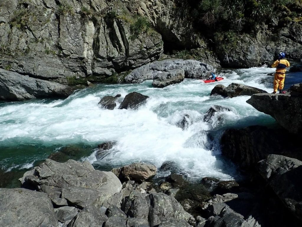
The Boomer Gorge is a sequence of 4 rapids> The the third and most continuous of the sequence is Class IV the others are Class III to III+.
Boomer is the most difficult rapid on the trip. At 25 cumec we skirted a very large (potentially packraft munching) hole in the middle of the rapid by running a chicken line river right. Some made the sensible choice of a portage river left. A few km on the valley opens out and farmland appears.
Erewhon to Springvale Reach
The tougher waters of the gorge ease into a cruisy 6.5km of Class II water to the Springvale Bridge take-out. There is a camping area at the take-out.
View Larger Topographic Map
River Gauge
The Gauge is Rangitikei at Pukeokahu.
https://envirodata.horizons.govt.nz/?siteName=Rangitikei%20at%20Pukeokahu&collectionName=Flow
River Valley suggests 20 cumecs is required for raft trips and used to run them in spring. Chris Bailey was able to paddle in early January with a flow of 11 cumecs. We think 15m3 is a good flow for Packrafts. Anything lower will be too slow on the last day’s big paddle.
We ran it at a perfect flow of 25 to 35 m3 off the back of a significant flood event. At this flow, we were able to paddle the Otamatenui without rock scratching. The Waipakahi gauge is a good indicator of whether the Otamatenui or indeed the Upper Rangitikei is flowing well.
This hydrograph for 2019 shows a short spring season where baseflow is in the right range. After December prolonged rain would be needed to get the river in the right range. Baseflow picks up in June but it’s too cold in this catchment to contemplate a winter trip.

Landowner Contacts
If planning on spending any time on the riverbanks these are the contacts
NZDF Major Billy Vince
Phone: (06) 387 5599 ext 7016
Mobile: 021 221 9181
Comment as of 2020 permission to set foot or camp on NZDF land will NOT be granted. Access is under review so fingers crossed as the Gates area has some great little terraces.
Oruamatua Kaimanawa Trust – As of 2020 permission to access the riverbank will not be granted
Bare Acre is the property south of the Defense land operating as Alpine Hunting. – Due to conflict with safari hunting, access to this land is precluded.
Ngamatea Station is river left below Waingakia and does not grant access.
In 2024 a group of packrafters was intercepted by landowner representatives on private land with rifles and have done considerable damage to the reputation of packrafters. Please don’t take rifles down this stretch of the river.
Here is a video of a spring trip that through good planning and good luck hit the river at a very sweet flow window. The party had contacted landowners and agreed access conditions.


